
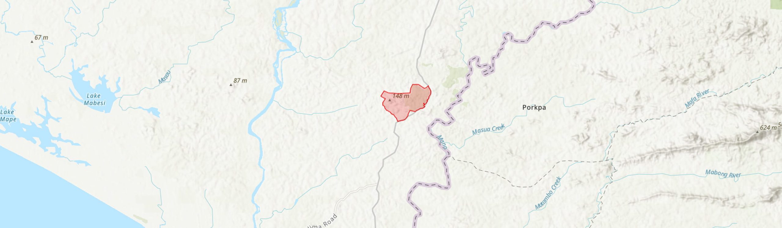
Country: Sierra Leone
Administrative region: Southern (Province)
Central co-ordinates: 7.17000 N, 11.37 W
Area: 13.9km²
Qualifying IPA Criteria
A(i)Site contains one or more globally threatened species
IPA assessment rationale
This site qualifies as an IPA due to the presence of 5 criterion A(i) trigger species. Without doubt there are many more undocumented threatened plant species in this forest.
Site description
The Werikenda Forest is located along the Zimmi-Bo highway in the Soro Gbema Chiefdom, in the Pujehun District of the Southern Province of Sierra Leone. This area also aligns with the Gonohun Forest Reserve (Protected Planet, 2024). Ownership and stewardship of the forest are shared among five local communities, including the villages of Gonohun, Wonde and Gbama. Of these, Gonohun manages the largest portion of the forest.
Botanical significance
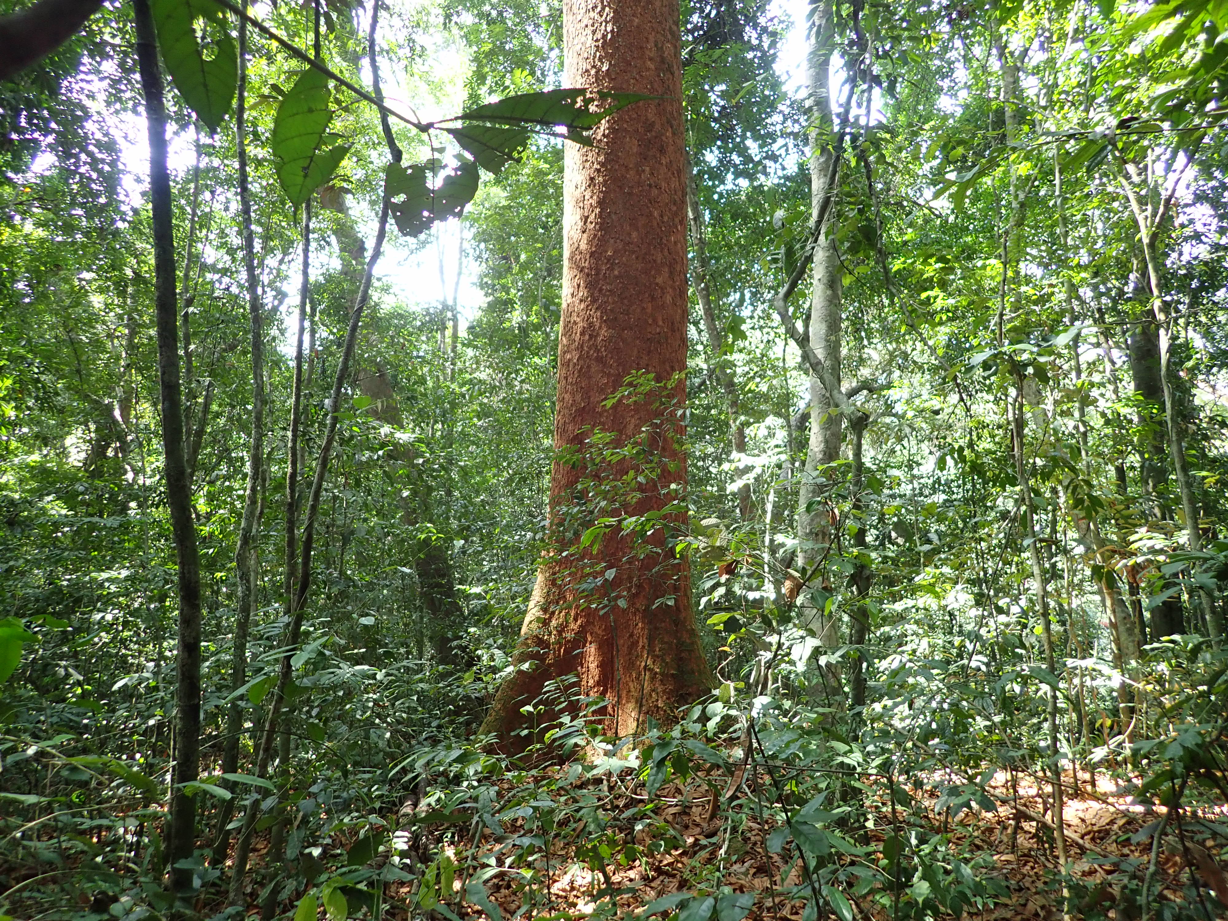
The Werikenda Forest represents an important remnant of Sierra Leone’s lowland evergreen forest, which is estimated to have declined by 90% nationally (NABSAP, 2017), which also corresponds to the Guinean Forests of West Africa biodiversity hotspot.
Surveys conducted by a TIPAs team on 16 February 2025 documented several plant species of conservation concern, including Aphanocalyx pteridophyllus (VU), Eremospatha dransfieldii (EN), Combretum longipilosum (NE), Lophira alata (VU), Placodiscus pseudostipularis (EN) and Trichoscypha longifolia (NT). These rare species are particularly sensitive to disturbance and may disappear entirely if the site is subjected to fire and further degradation. Fruits of the large liana Strychnos camptoneura were seen in several places by the TIPA's team in 2025, but not yet collected. This species had not yet been recorded in Sierra Leone. Turraea leonensis (maybe VU) was collected in flower, it is a species not yet assessed by the IUCN. Without doubt there are many more undocumented threatened plant species in this forest.
Habitat and geology
The vegetation is characterized by lowland evergreen closed forest, exhibiting varying levels of disturbance. Characteristic species of west evergreen forest such as Diospyros chevalieri, Heritiera utilis and Lophira alata are common (pers. obs., 2025; Hawthorne & Jongkind, 2006). Parts of the forest are dominated by Aphanocalyx pteridophyllus; these parts have probably not been disturbed for at least several generations of trees. Other parts of the forest are dominated by Lophira alata, a species known to regenerate commonly after disturbance (X. van der Burgt, pers. comms., 2025). Several drainage lines are present, retaining water during the dry season. The site lies on the Granite Greenstone terrain (Culver & Williams, 1979).
Conservation issues
The Werikenda Forest was protected by communities, with no large-scale logging activities for approx. 200 years. However, between 2006-2025, forest cover declined from 12 km² to 8.48 km²—an average annual loss of about 0.18 km², based on satellite imagery (Google Earth, 2025). Although this rate is lower than the national average annual forest loss of just under 3% (Malan et al., 2022), it highlights an accelerating threat. Logging, particularly for planks, is driven by inter-community competition over resources, and is the primary driver of degradation. Cleared areas are frequently converted to subsistence agriculture through slash-and-burn practices, while increased human activity, including hunting and noise from chainsaws, is likely disrupting key animal seed dispersers. These pressures reflect a tragedy of the commons, where shared ownership without strong governance has led to overexploitation. Although conversations with local elders and the paramount chief during 2025 fieldwork suggest openness to conservation, urgent intervention is needed to implement sustainable community forest management.
Ecosystem services
The Werikenda Community Forest provides a wide range of ecosystem services that are vital to local communities. The forest supports provisioning services through the supply of non-timber forest products, such as medicinal plants, wild fruits, and bushmeat, which contribute to local food security and traditional healthcare practices. Furthermore, the forest holds important cultural and spiritual value for the surrounding communities. Timber extraction, although now a significant threat, provides income for communities in the short-term. At the current rate of loss seen on Google Earth (2025), the entire forest will be gone in 45 years.
Site assessor(s)
Assessed by:
Gabriella Hoban, Royal Botanic Gardens, Kew
Xander van der Burgt, Royal Botanic Gardens, Kew
Date of first assessment: 16th Feb 2025
Reviewed by:Martin Cheek, The Royal Botanic Gardens Kew
IPA criterion A species
| Species | Qualifying sub-criterion | ≥ 1% of global population | ≥ 5% of national population | 1 of 5 best sites nationally | Entire global population | Socio-economically important | Abundance at site |
|---|---|---|---|---|---|---|---|
| Eremospatha dransfieldii Sunderl. | A(i) |  |
|
|
 |
|
Occasional |
| Aphanocalyx pteridophyllus (Harms) Wieringa | A(i) | |
|
|
|
|
Occasional |
| Homalium smythei Hutch. & Dalziel | A(i) | |
|
|
|
|
Frequent |
| Lophira alata Banks ex Gaertn.f. | A(i) | |
|
|
|
|
Common |
| Placodiscus pseudostipularis Radlk. | A(i) | |
|
|
|
|
Occasional |
Eremospatha dransfieldii Sunderl.
Qualifying sub-criterion:
A(i)
≥ 1% of global population:
≥ 5% of national population:
1 of 5 best sites nationally:
Entire global population:
Socio-economically important:
Abundance at site:
Occasional
Aphanocalyx pteridophyllus (Harms) Wieringa
Qualifying sub-criterion:
A(i)
≥ 1% of global population:
≥ 5% of national population:
1 of 5 best sites nationally:
Entire global population:
Socio-economically important:
Abundance at site:
Occasional
Homalium smythei Hutch. & Dalziel
Qualifying sub-criterion:
A(i)
≥ 1% of global population:
≥ 5% of national population:
1 of 5 best sites nationally:
Entire global population:
Socio-economically important:
Abundance at site:
Frequent
Lophira alata Banks ex Gaertn.f.
Qualifying sub-criterion:
A(i)
≥ 1% of global population:
≥ 5% of national population:
1 of 5 best sites nationally:
Entire global population:
Socio-economically important:
Abundance at site:
Common
Placodiscus pseudostipularis Radlk.
Qualifying sub-criterion:
A(i)
≥ 1% of global population:
≥ 5% of national population:
1 of 5 best sites nationally:
Entire global population:
Socio-economically important:
Abundance at site:
Occasional
IPA criterion C qualifying habitats
| Habitat | Qualifying sub-criterion | ≥ 5% of national resource | ≥ 10% of national resource | 1 of 5 best sites nationally | Areal coverage at site |
|---|---|---|---|---|---|
| Low-altitude evergreen forest and gallery forest | C(i) | |
|
|
Low-altitude evergreen forest and gallery forest
Qualifying sub-criterion:
C(i)
≥ 5% of national resource:
≥ 10% of national resource:
Areal coverage at site:
General site habitats
| General site habitat | Percent coverage | Importance |
|---|---|---|
| Forest - Subtropical/Tropical Moist Lowland Forest | |
Major |
Forest - Subtropical/Tropical Moist Lowland Forest
Percent coverage:
Importance:
Major
Land use types
| Land use type | Percent coverage | Importance |
|---|---|---|
| Harvesting of wild resources | |
Major |
| Nature conservation | |
Harvesting of wild resources
Percent coverage:
Importance:
Major
Nature conservation
Percent coverage:
Importance:
Threats
| Threat | Severity | Timing |
|---|---|---|
| Residential & commercial development - Housing & urban areas | Low | Ongoing - increasing |
| Agriculture & aquaculture - Annual & perennial non-timber crops - Small-holder farming | Medium | Ongoing - increasing |
| Biological resource use - Logging & wood harvesting - Intentional use: large scale (species being assessed is the target) [harvest] | High | Ongoing - increasing |
| Natural system modifications - Fire & fire suppression - Increase in fire frequency/intensity | Medium | Ongoing - increasing |
Residential & commercial development - Housing & urban areas
Severity:
Low
Timing:
Ongoing - increasing
Agriculture & aquaculture - Annual & perennial non-timber crops - Small-holder farming
Severity:
Medium
Timing:
Ongoing - increasing
Biological resource use - Logging & wood harvesting - Intentional use: large scale (species being assessed is the target) [harvest]
Severity:
High
Timing:
Ongoing - increasing
Natural system modifications - Fire & fire suppression - Increase in fire frequency/intensity
Severity:
Medium
Timing:
Ongoing - increasing
Protected areas
| Protected area name | Protected area type | Relationship with IPA | Areal overlap |
|---|---|---|---|
| Gonohun Community Forest | Community conservation area | protected/conservation area overlaps with IPA | |
Gonohun Community Forest
Protected area type:
Community conservation area
Relationship with IPA:
protected/conservation area overlaps with IPA
Areal overlap:
Bibliography
Google Earth Satellite Imagery
Global Forest Watch
Protected Areas (WDPA)
Sierra Leone's Second National Biodiversity Strategy and Action Plan 2017-2026
Evaluating the impacts of a large-scale voluntary REDD+ project in Sierra Leone
nature sustainability, Vol 7, page(s) 120-129
Late Precambrian andPhanerozoic geology of Sierra Leone
Geological Society of London, Vol 136, page(s) 605-618
Woody Plants of West African Forests: A guide to the forest trees, shrubs and lianes from Senegal to Ghana


Recommended citation
Gabriella Hoban, Xander van der Burgt (2026) Tropical Important Plant Areas Explorer: Werikenda Forest (Sierra Leone). https://tipas.kew.org/site/werikenda-forest/ (Accessed on 25/08/2026)