Country: Mozambique
Administrative region: Inhambane (Province)
Central co-ordinates: 21.67864 S, 34.98088 E
Area: 678km²
Qualifying IPA Criteria
A(i)Site contains one or more globally threatened species
IPA assessment rationale
Temane qualifies as an IPA under Criterion A(i), as this area supports important populations of five globally threatened species: Bauhinia burrowsii (EN), Croton aceroides (EN), Triaspis suffulta (EN), Croton inhambanensis (VU) and Ozoroa gomesiana (VU). This IPA is so far known to support six national endemic species (Darbyshire et al. 2019); this is below the 3% threshold of Mozambican endemic and range restricted species needed to qualify this site under Criterion B(ii).
Site description
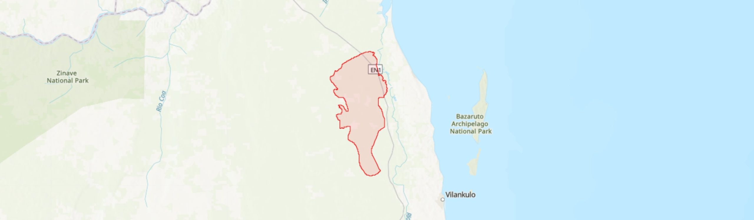
The Temane IPA lies entirely within Inhassoro District in northern Inhambane Province and covers an area of 678 km2 between the latitudes -21.49° to -21.91° and longitudes 34.89° to 35.04°. The boundaries of this IPA were primarily delineated to encompass important habitats that support both a notable number of plant species endemic to Mozambique, including five threatened species, and a range of ecosystems service that the habitats provide.
Inhassoro District has, in recent years, attracted significant economic interest related to the exploitation of mineral resources. The critical areas for biodiversity within the Temane IPA fall within one of the largest natural gas and heavy sand deposits in Mozambique, centred on Temane, Maimelane, and Cometela villages (MAE 2005; IMPACTO 2018). These developments, in addition to the activities of local communities, are impacting negatively on the IPA through the transformation and degradation of its ecosystems (MICOA 2012).
Botanical significance
This IPA is of high botanical importance primarily because of the presence of thicket and dry woodland habitats that support a number of northern Inhambane’s endemic and range-restricted species of conservation importance. Five of these species are assessed as globally threatened on the IUCN Red List: Bauhinia burrowsii (EN; restricted to Inhassoro, Vilanculos and Mapinhane areas of Inhambane), Croton aceroides (EN; encountered in two sites in Inhassoro District, and from between Mabote and Funhalouro in northern Inhambane, and near Panda and Homoine further south in Inhambane), the woody climber Triaspis suffulta (EN: restricted to the Inhassoro and Vilanculos areas), Croton inhambanensis (VU; restricted to Inhassoro and Mapinhane) and Ozoroa gomesiana (VU; found only in northern Inhambane, mostly concentrated in the Inhassoro, Mapinhane and Vilanculos areas). All these species are endemics of the proposed Inhambane (sub-) Centre of Plant Endemism (Darbyshire et al. 2019).
This IPA is so far known to support six national endemic plant taxa and one near-endemic plant taxa. The endemic species to Mozambique consist of the five previously mentioned globally threatened species, plus the Least Concern species Dolichandrone alba.
Habitat and geology
In the broad sense, the Temane region lies within the Swahilian-Maputaland Regional Transition Zone phytogeographical region according to Clarke (1998), which covers much of the coastal-belt of Mozambique, or according to Schipper and Burgess (2015), the Southern Zanzibar-Inhambane Coastal Forest Mosaic Ecoregion which stretches for around 2,200 km along the eastern coast of the African continent, from southern Tanzania to Xai-Xai (Gaza Province) in Mozambique. In a narrower phytogeographical sense, this IPA falls within the northern extension of the Maputaland Centre of Endemism, recently proposed as the Inhambane (sub-) Centre of Endemism (Darbyshire et al. 2019).
The climate is influenced by the warm current from the Mozambique Channel and is characterised as humid tropical by the coastline and dry tropical inland. The site experiences two seasons; the wet season runs from August to February, whilst the dry and relatively cool season runs from February to July. In the wet season, the average temperatures vary between 28 – 30°C, while in the dry season the temperatures vary between 18 – 27°C. The average annual rainfall ranges from 865 – 936 mm, with higher rainfall on the coast (Governo do Distrito de Inhassoro 2011; Global Forest Watch 2021). The elevation of the IPA ranges from 20 – 65 m asl. The region is part of the great coastal plains that stretch along a large extent of coastal Mozambique, and is characterized by red clay soils and sodic soils (mananga soils) dominating the inland zones (MICOA 2012).
Inhassoro District has been subject to several recent botanical surveys, which have helped to build our understanding of plant diversity in the Temane IPA region. Three main types of vegetation can be distinguished at this site. (1) A miombo woodland and grassland mosaic is encountered in the south of the IPA and consists of open woodland of medium sized-trees and shrubs (with ca. 35% canopy cover), with dominant species being Julbernardia globiflora and Brachystegia spiciformis accompanied by species such as Afzelia quanzensis, Albizia adianthifolia, Garcinia livingstonei and Pterocarpus angolensis, and with grassland with ca. 50% ground cover, featuring e.g. Eragrostis chapelieri, Melinis repens, Perotis patens, Schizachyrium sanguineum and Sporobolus pyramidalis dominating the landscape (Deacon 2014). (2) Mixed dry forest-woodland, which is the most extensive type of vegetation found at this site, and also features miombo species, but with the canopy here is dominated by tree species such as Afzelia quanzensis, Albizia adianthifolia, Balanites maughamii, Garcinia livingstonei, Guibourtia conjugata, Pterocarpus angolensis and Suregada zanzibariensis (MICOA 2012; Deacon 2014). This habitat is a mosaic of open woodland of medium-sized trees and shrubs (of ca. 30% cover), and an herbaceous ground cover (ca. 60%), with common grasses including Megathyrsus maximus, Schizachyrium sanguineum and Sporobolus pyramidalis. (3) Sand thicket, sometimes interspersed within the miombo woodland and mixed dry forest-woodland vegetation types, this habitat is widespread within the IPA, particularly in the northeast, and comprises dense and short semi-deciduous species dominated by Hymenocardia ulmoides and Spirostachys africana, with emergent trees of Adansonia digitata, Balanites maughamii and Cordyla africana. Climbers are numerous and include Ancylobotrys petersiana, Apodostigma pallens, Artabotrys brachypetalus, Artabotrys monteiroae and Monodora junodii var. junodii among others (Deacon 2014; Lötter et al. in prep.). These areas of thicket have a canopy cover ranging from 25 – 45% and a sparse herbaceous ground cover of 3 – 10% (Deacon 2014). This latter vegetation type corresponds to the Pande Sand Thicket of Lötter et al. (in prep.), a highly range-restricted vegetation unit the majority of which lies within the Temane IPA, and is of particular importance for most of the range-restricted and threatened species of this site.
Conservation issues
The Temane IPA does not lie within a formal protected area, however, the region is covered by the recently identified “Inhassoro-Vilanculos KBA” (WCS et al. 2021).
More generally, this IPA is currently under high pressure and degradation by local communities because of the harvesting of firewood, charcoal production, livestock grazing, agriculture (concentrated along the access roads and paths), with an associated increase in fire frequency, and expansion of settlements (A. Massingue, pers. comm. 2020; Global Forest Watch 2021; Google Earth 2021). In addition, Temane IPA is experiencing habitat degradation due to activities related to natural gas exploration around Temane village and heavy sand exploitation in Maimelane and Cometela villages.
Cultivated areas are concentrated along access roads and paths, and notably near Sasol’s oil flowlines which occur across the vegetation mosaics of this IPA and themselves cause a level of habitat degradation (Deacon 2014; Google earth 2021).
Ecosystem services
The vegetation of the Temane IPA is of great importance as a biodiverse area for both plant species and a range of fauna (for example, endemic reptiles such as Panaspis and Atractaspis spp.) (Deacon 2014). The forests contribute significantly to carbon storage and climate regulation, particularly related to the precipitation cycle. Moreover, the local communities also take advantage of these terrestrial habitats, where they harvest firewood, wild fruits and medicinal plants, construction materials (sand, rock, lime and wood), and wood for fuel or charcoal production (A. Massingue, pers. comm. 2020). At present, however, the extraction of goods provided by this site constitute a threat to its ecosystems due to the high demand and lack of sustainable management.
Site assessor(s)
Castigo Datizua, Agricultural Research Institute of Mozambique (IIAM)
Clayton Langa, Agricultural Research Institute of Mozambique (IIAM)
Iain Darbyshire, Royal Botanic Gardens, Kew
Sophie Richards, Royal Botanic Gardens, Kew
IPA criterion A species
| Species | Qualifying sub-criterion | ≥ 1% of global population | ≥ 5% of national population | 1 of 5 best sites nationally | Entire global population | Socio-economically important | Abundance at site |
|---|---|---|---|---|---|---|---|
| Ozoroa gomesiana R.Fern. & A.Fern. | A(i) |  |
|
|
 |
|
Abundant |
| Triaspis suffulta Launert | A(i) | |
|
|
|
|
Scarce |
| Bauhinia burrowsii E.J.D.Schmidt | A(i) | |
|
|
|
|
Abundant |
| Croton aceroides Radcl.-Sm. | A(i) | |
|
|
|
|
Scarce |
| Croton inhambanensis Radcl.-Sm. | A(i) | |
|
|
|
|
Frequent |
Ozoroa gomesiana R.Fern. & A.Fern.
Qualifying sub-criterion:
A(i)
≥ 1% of global population:
≥ 5% of national population:
1 of 5 best sites nationally:
Entire global population:
Socio-economically important:
Abundance at site:
Abundant
Triaspis suffulta Launert
Qualifying sub-criterion:
A(i)
≥ 1% of global population:
≥ 5% of national population:
1 of 5 best sites nationally:
Entire global population:
Socio-economically important:
Abundance at site:
Scarce
Bauhinia burrowsii E.J.D.Schmidt
Qualifying sub-criterion:
A(i)
≥ 1% of global population:
≥ 5% of national population:
1 of 5 best sites nationally:
Entire global population:
Socio-economically important:
Abundance at site:
Abundant
Croton aceroides Radcl.-Sm.
Qualifying sub-criterion:
A(i)
≥ 1% of global population:
≥ 5% of national population:
1 of 5 best sites nationally:
Entire global population:
Socio-economically important:
Abundance at site:
Scarce
Croton inhambanensis Radcl.-Sm.
Qualifying sub-criterion:
A(i)
≥ 1% of global population:
≥ 5% of national population:
1 of 5 best sites nationally:
Entire global population:
Socio-economically important:
Abundance at site:
Frequent
General site habitats
| General site habitat | Percent coverage | Importance |
|---|---|---|
| Forest - Subtropical/Tropical Dry Forest | |
Major |
| Grassland - Subtropical/Tropical Dry Lowland Grassland | |
Major |
| Shrubland - Subtropical/Tropical Dry Shrubland | |
Major |
| Artificial - Terrestrial - Subtropical/Tropical Heavily Degraded Former Forest | |
Major |
| Artificial - Terrestrial - Arable Land | |
Major |
| Savanna - Moist Savanna | |
Major |
Forest - Subtropical/Tropical Dry Forest
Percent coverage:
Importance:
Major
Grassland - Subtropical/Tropical Dry Lowland Grassland
Percent coverage:
Importance:
Major
Shrubland - Subtropical/Tropical Dry Shrubland
Percent coverage:
Importance:
Major
Artificial - Terrestrial - Subtropical/Tropical Heavily Degraded Former Forest
Percent coverage:
Importance:
Major
Artificial - Terrestrial - Arable Land
Percent coverage:
Importance:
Major
Savanna - Moist Savanna
Percent coverage:
Importance:
Major
Land use types
| Land use type | Percent coverage | Importance |
|---|---|---|
| Agriculture (arable) | |
Major |
| Extractive industry | |
Major |
| Residential / urban development | |
Major |
| Utility & service lines for telecommunication and gas pipelines crossing | |
Major |
| Harvesting of wild resources | |
Major |
| Forestry | |
Unknown |
Agriculture (arable)
Percent coverage:
Importance:
Major
Extractive industry
Percent coverage:
Importance:
Major
Residential / urban development
Percent coverage:
Importance:
Major
Utility & service lines for telecommunication and gas pipelines crossing
Percent coverage:
Importance:
Major
Harvesting of wild resources
Percent coverage:
Importance:
Major
Forestry
Percent coverage:
Importance:
Unknown
Threats
| Threat | Severity | Timing |
|---|---|---|
| Residential & commercial development - Housing & urban areas | High | Ongoing - trend unknown |
| Residential & commercial development - Commercial & industrial areas | High | Ongoing - trend unknown |
| Agriculture & aquaculture - Annual & perennial non-timber crops - Shifting agriculture | High | Ongoing - trend unknown |
| Agriculture & aquaculture - Wood & pulp plantations - Small-holder plantations | Low | Ongoing - trend unknown |
| Agriculture & aquaculture - Livestock farming & ranching - Small-holder grazing, ranching or farming | Low | Ongoing - trend unknown |
| Energy production & mining - Oil & gas drilling | High | Ongoing - trend unknown |
| Energy production & mining - Mining & quarrying | Unknown | Ongoing - trend unknown |
| Transportation & service corridors - Roads & railroads | High | Ongoing - trend unknown |
| Biological resource use - Logging & wood harvesting | High | Ongoing - trend unknown |
| Natural system modifications - Fire & fire suppression - Increase in fire frequency/intensity | Unknown | Ongoing - trend unknown |
| Invasive & other problematic species, genes & diseases - Invasive non-native/alien species/diseases | Medium | Ongoing - trend unknown |
Residential & commercial development - Housing & urban areas
Severity:
High
Timing:
Ongoing - trend unknown
Residential & commercial development - Commercial & industrial areas
Severity:
High
Timing:
Ongoing - trend unknown
Agriculture & aquaculture - Annual & perennial non-timber crops - Shifting agriculture
Severity:
High
Timing:
Ongoing - trend unknown
Agriculture & aquaculture - Wood & pulp plantations - Small-holder plantations
Severity:
Low
Timing:
Ongoing - trend unknown
Agriculture & aquaculture - Livestock farming & ranching - Small-holder grazing, ranching or farming
Severity:
Low
Timing:
Ongoing - trend unknown
Energy production & mining - Oil & gas drilling
Severity:
High
Timing:
Ongoing - trend unknown
Energy production & mining - Mining & quarrying
Severity:
Unknown
Timing:
Ongoing - trend unknown
Transportation & service corridors - Roads & railroads
Severity:
High
Timing:
Ongoing - trend unknown
Biological resource use - Logging & wood harvesting
Severity:
High
Timing:
Ongoing - trend unknown
Natural system modifications - Fire & fire suppression - Increase in fire frequency/intensity
Severity:
Unknown
Timing:
Ongoing - trend unknown
Invasive & other problematic species, genes & diseases - Invasive non-native/alien species/diseases
Severity:
Medium
Timing:
Ongoing - trend unknown
Conservation designation
| Designation name | Protected area | Relationship with IPA | Areal overlap |
|---|---|---|---|
| Inhassoro-Vilankulos | Key Biodiversity Area | protected/conservation area encompasses IPA | |
Inhassoro-Vilankulos
Protected area:
Key Biodiversity Area
Relationship with IPA:
protected/conservation area encompasses IPA
Areal overlap:
Management type
| Management type | Description | Year started | Year finished |
|---|---|---|---|
| No management plan in place | |
|
No management plan in place
Year started:
Year finished:
Bibliography
The endemic plants of Mozambique: diversity and conservation status
PhytoKeys, Vol 136, page(s) 45-96 Available online
Trees and Shrubs Mozambique
Google Earth Satellite Imagery
Global Forest Watch
Historical Vegetation Map and Red List of Ecosystems Assessment for Mozambique – Version 1.0 – Final report
Ecological Assessment and Biogeography of Coastal Vegetation and Flora in Southern Mozambique
Department of Botany, Faculty of Science; NELSON MANDELA UNIVERSITY
A new regional centre of endemism in Africa. In: Aspects of the ecology, taxonomy and chorology of the floras of Africa and Madagascar.
Kew Bulletin Additional Series (pub. Royal Botanic Gardens, Kew)
Environmental Impact Assessment for Sasol PSA and LPG Project: Terrestrial Fauna Impact Assessment. Specialist Report 10. SASOL Petroleum Mozambique Limitada & Sasol Petroleum Temane Lda
Plano Estratégico de Desenvolvimento Distrital (2011-2015)
Sasol Petroleum Mozambique. Categorização da Área de Nhangonzo, Inhambane, Moçambique. Referência do Documento: MSSP1701-IMP180407 – Rev 01.
Perfil Ambiental e Mapeamento do uso Actual da Terra nos Distritos da Zona Costeira de Moçambique. Distrito de Inhassoro. Versão Preliminar.
Plano de acção para a prevenção e controlo da erosão de solos 2008 – 2018.
Relatório nacional sobre ambiente marinho e costeiro
Perfil do Distrito de Inhassoro, Província de Inhambane
Southern-east Africa: Mozambique, Tanzania, Malawi and Zimbabwe
Key Biodiversity Areas (KBAs) Identified in Mozambique: Factsheets VOL. II. Red List of threatened species and ecosystems, identification and mapping of key biodiversity areas (KBAs) in Mozambique. USAID / SPEED+


Recommended citation
Castigo Datizua, Clayton Langa, Iain Darbyshire, Sophie Richards (2024) Tropical Important Plant Areas Explorer: Temane (Mozambique). https://tipas.kew.org/site/temane/ (Accessed on 27/07/2024)