Country: Mozambique
Administrative region: Cabo Delgado (Province)
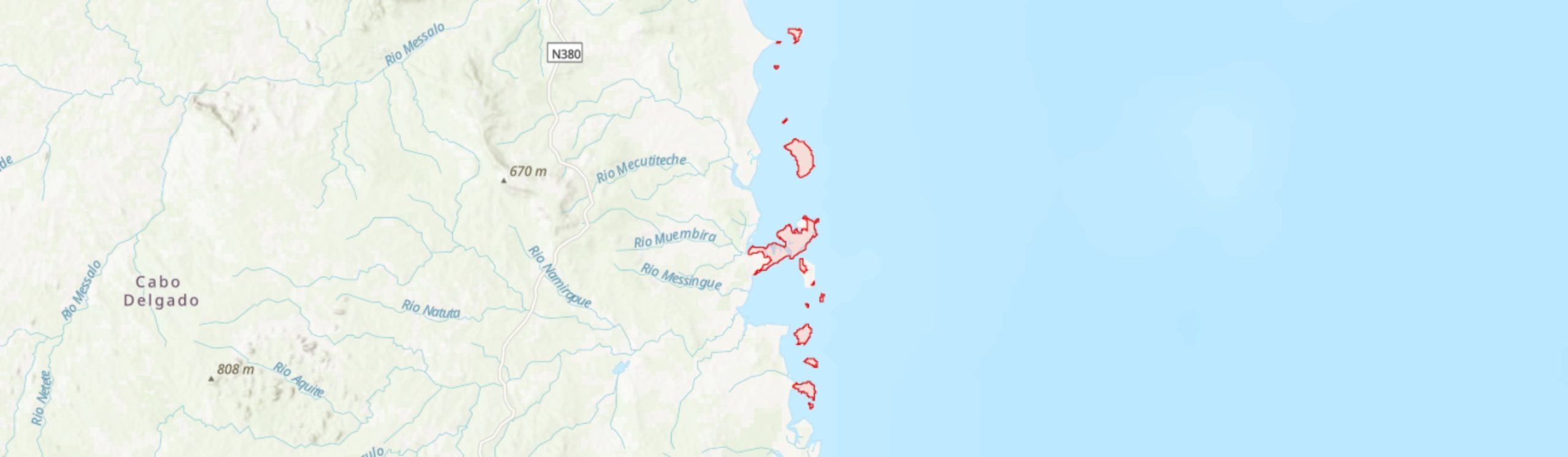
Central co-ordinates: 12.3505 S, 40.61000 E
Area: 108km²
Qualifying IPA Criteria
A(i)Site contains one or more globally threatened species
IPA assessment rationale
The Quirimbas Islands qualify as an IPA under criterion A(i) as they contain a globally important population of Nectaropetalum carvalhoi (VU), and are likely to contain a globally important population of Pavetta mocambicensis (EN). These islands are also the only known site in Mozambique for Barleria rhynchocarpa (VU) and so are of national importance for this species.
Site description
The Quirimbas Islands IPA is situated in Ibo, Macomia and Quissanga Districts of Cabo Delgado Province along the Indian Ocean coastline, between -11.97° and -12.69° latitude. It comprises the southern islands of the Quirimba Archipelago, with a total of 12 islands and islets of coralline rock included or partially included within the IPA, namely from north to south: Makaloe, Mogudala, Rolas, Matemo, Ibo, Quirimba, Sencar, Quilalea, Mefunvo, Quisiva, Situ and Quipaco. All of these islands are located within the Quirimbas National Park (QNP) and UNESCO Biosphere Reserve, with the exception of Makaloe Island which falls within the QNP buffer zone. Some of the larger islands have a long history of occupation, including Matemo (the largest of the islands at ca. 25 km2), Ibo and Quirimba. The latter two islands are extensively transformed, and so only the more intact habitats on those islands are included within the IPA boundary. The large mangrove forests that stretch west of Ibo towards the continental coastline near Quissanga are also included within the IPA boundary, as is the Pangane Peninsula, a coral rag outcrop attached to the mainland to the west of Makaloe Island. Together, these islands and peninsula contain some of the best examples of coral rag thicket and mangroves in Mozambique and support a number of scarce and threatened species. Several of the islands are yet to be botanised, but are included within the IPA as they support most of the same habitats as the islands that have been explored botanically.
Botanical significance
The southern Quirimbas Islands are notable for the presence of extensive intact thickets on coral rag; these are particularly well developed on the sparsely populated and uninhabited islands. Whilst coral rag thicket is relatively widespread along the coast of northern Mozambique, these islands hold some of the best examples of this habitat type nationally. These thickets contain a number of noteworthy species. Of particular importance, this IPA is likely to be the most important site globally for Nectaropetalum carvalhoi (VU), a shrub or small tree that is noted to be easily seen on some of these islands (Burrows et al. 2018), with records from the Pangane Peninsula and from Makaloe Island in the north of the IPA (E. Schmidt, pers. comm. 2020). Ibo Island is the type locality for Pavetta mocambicensis (EN), recorded there by Manuel Rodrigues de Carvalho in the late 19th Century but not collected from the islands since that time. These islands are also the only known site in Mozambique for Barleria rhynchocarpa (VU), an attractive yellow or orange flowered herb or subshrub that favours coastal thickets, grasslands and foreshores - the type locality is from Quirimbas Island whilst a more recent collection, from 1948, was made from Ibo Island (Pedro & Pedrogão #5046). The continued presence of the latter two species within this IPA requires confirmation but they are likely to still be present given the extensive suitable habitat still intact here. Other noteworthy species include the scarce Mozambique endemic Ochna angustata (NT). Botanical surveying of these islands has been incomplete to date and the likelihood of recording further species of conservation concern in the future is high, and a full botanical inventory should be considered a high priority for this IPA.
Whilst mangroves are generally low in plant diversity and most of the species present within this habitat are widespread, the mangroves in the vicinity of Quissanga are noteworthy for the presence of the parasitic mangrove shrub Viscum littorum (NT). This species is a highly localised endemic of northern Mozambique, otherwise known only from the vicinity of Pemba [MOZTIPA024]. It is considered to be near-threatened due to the ongoing loss of mangrove habitat within its small range, although it is likely to be under-recorded given the limited botanical survey within these extensive and often inaccessible mangrove communities to date (Alves et al. 2014).
Habitat and geology
The low-lying islands and peninsulas of the Quirimbas Islands IPA are formed from outcrops of coral rag of Pleistocene age (Carvalho & Bandeira 2003), which support thin, sand-rich soils with frequent areas of exposed, sharp rock. Some of the islands have small coralline sea cliffs of up to 8 m high. Coral rag thicket dominates the undisturbed vegetation of the islands and the Pangane Peninsula. This is a short, dense thicket of 2 – 7 m tall with a rather low diversity of woody species. Dominant species in this habitat include Cassipourea mossambicensis, Coptosperma littorale, Diospyros consolitae, Erythroxylum platyclados, Euclea spp., Mimusops obtusifolia and Olax dissitiflora amongst others (Burrows et al. 2018). Borghesio & Gagliardi (2015) also note Commiphora spp. and Salvadora persica as frequent. Herbaceous species are rather scarce. The upper beach margins often have a distinctive thicket assemblage of species with Indo-Pacific distributions, such as Colubrina asiatica, Pemphis acidula and Suriana maritima (Burrows et al. 2018).
In disturbed area, a more open thicket and grassland occurs. Whilst the coral rag soils are generally unsuitable for agriculture, some farming occurs in areas with better-developed sandy soils, and there has also been some planting of exotic trees such as coconut palms.
Extensive mangrove communities are recorded along the coastline mainly on the western side of the islands, with the vast mangrove forests west of Ibo towards Quissinga - the “Ibo stand” (ca. 17 km2) - included within the IPA boundary. Smaller mangrove communities occur around the other islands. Eight species of mangrove are noted to occur here, the dominant species being Rhizophora mucronata (Barnes 2001).
The eastern shores of the islands are typically fringed by coral reefs whereas the more sheltered western shores are generally fringed by shallow waters with sandy seabeds and extensive seagrass communities. A total of 10 seagrass species have been recorded from Montepuez Bay to the west of Quirimba Island, with the dominant species including Thalassia hemprichii in the intertidal areas and Enhalus acorioides and Thalassodendron ciliatum in the subtidal zones (Bandeira & Gell 2003); no threatened seagrass species have been noted to date. The extensive intertidal areas also support diverse macroalgal communities; recent surveys of the seaweed flora revealed 27 new records for Mozambique out of a total of 101 taxa recorded around the islands, mainly occurring in coral reef habitats but also amongst the seagrass beds (Carvalho & Bandeira 2003). These marine communities are not included within the IPA boundary at present but may be added in future once a full threat assessment of these habitats and their plant species has been carried out.
The climate is warm throughout the year; temperatures peak in December with an average high of 30.4°C, and are at their lowest in July when the average high is 26.7°C at Ibo. Average annual rainfall at Ibo is 1,047 mm whilst at Quissanga it is 1,320 mm; the rainy season peaks in December to March, with a prolonged dry season from May to November. However, humidity remains high throughout the year at over 70% (climate-data.org).
Conservation issues
The Quirimbas National Park (QNP), an extensive area of ca. 9,013 km2 of both marine and terrestrial environments, was established in 2002 following a consultation process with local communities who recognised the need to preserve the natural resources on which they depend (Harari 2005). A multi-stakeholder approach was taken from the outset, including national and provincial government, NGOs, private investors and local communities. The aim of the QNP is to balance biodiversity conservation with improved local livelihoods through securing useful natural resources and developing income-generating opportunities from the park for local communities, particularly through ecotourism. Supported by the French Development Agency AFD (2002 – 2017), a management plan was developed by WWF who managed the park until 2010, together with the establishment of infrastructure, training of park staff, and funding for community-based projects. The site was also designated as a UNESCO Biosphere Reserve in 2018.
Much of the conservation focus to date has been on the rich marine environments within the QNP, in particular the protection of fisheries against over-harvesting (Harari 2005). The coastal waters of the park, and associated extensive coral reefs, seagrass communities and mangroves, provide feeding and/or nesting grounds for sea turtles, dugongs, cetaceans and a high diversity of fish, many of which are of conservation importance (Harari 2005). The islands and their coasts are also of international importance for migratory Palearctic birds, supporting as a wetland of international importance based on the Ramsar criteria (Borghesio & Gagliardi 2011).
Despite a range of projects having been implemented within the QNP, little is known about their effectiveness in contributing to biodiversity conservation in the park, in part due to lack of baseline data and monitoring, and many projects are not considered to have been successful in achieving their desired outcomes or have been stopped prematurely (Chevallier 2018). It has also been noted that the lack of inventories for many groups of terrestrial organisms hinders the development of a comprehensive management plan for the Park or access to funding (Harari 2005). The recent violent insurgency in Cabo Delgado Province has made on-the-ground management more difficult as well as halting tourist revenue streams for the QNP.
Threats to the terrestrial environments on the islands are not considered to be severe at present. Most of the inhabitants of the islands are reliant on fishing as their main source of subsistence and income. Some of the more accessible and long-inhabited islands have experienced habitat transformation for subsistence agriculture, although this is limited by the thin, low fertility soils and the lack of available freshwater (Chevallier 2018). Agriculture most notably impacts the islands of Matemo, Ibo and Quirimba, much of the lattermost island is excluded from the IPA as extensive areas are given over to coconut plantations. Although there is some cutting of mangroves in accessible areas for poles, the mangroves within the QNP are largely intact and are actually experiencing net gains across the Quirimbas landscape (Shapiro et al. 2020).
A significant future threat to the islands is from climate change, including rising sea levels and increased frequency of extreme weather events. The islands were severely impacted by Cyclone Kenneth in 2019, the most severe tropical cyclone in Mozambique since modern records began.
Ecosystem services
The islands supported a resident population of ca. 9,000 inhabitants in 1998, but this number is increased significantly by the transient presence of fishermen, attracted by the rich fishing waters (Harari 2005). Fish provides the major source of protein for local residents; fishing is mainly carried out at a subsistence and local market scale because of lack of access to larger commercial markets. The extensive mangrove stands, seagrass communities and coral reefs are all important areas for marine biodiversity and support the rich fisheries. The intact coastal habitats are also an important buffer to coastal erosion and extreme weather events in this region.
There is high potential for sustainable ecotourism as a source of local revenue and to support the QNP and its biodiversity. Prior to the recent insurgency in Cabo Delgado, tourism from South Africa and Zimbabwe was increasing, with the main attractions including the coral sand beaches, diving and snorkeling activities. Resorts and lodges have been developed on several of the islands. Ibo Island is also of historical importance, as a major early Indian Ocean trading port until the early 20th Century. There is much evidence of its significance within the Portuguese empire, including 17th century fortifications in Vila de Ibo, that could attract tourism. However, there are a number of challenges to realising the tourism potential of this site. These include the difficulties of balancing tourism development with nature conservation, and the need to better involve local communities in Park activities and management and the economic benefits they bring.
Site assessor(s)
Iain Darbyshire, Royal Botanic Gardens, Kew
IPA criterion A species
| Species | Qualifying sub-criterion | ≥ 1% of global population | ≥ 5% of national population | 1 of 5 best sites nationally | Entire global population | Socio-economically important | Abundance at site |
|---|---|---|---|---|---|---|---|
| Nectaropetalum carvalhoi Engl. | A(i) |  |
|
|
 |
|
Common |
| Pavetta mocambicensis Bremek. | A(i) | |
|
|
|
|
Unknown |
| Barleria rhynchocarpa Klotzsch | A(i) | |
|
|
|
|
Unknown |
Nectaropetalum carvalhoi Engl.
Qualifying sub-criterion:
A(i)
≥ 1% of global population:
≥ 5% of national population:
1 of 5 best sites nationally:
Entire global population:
Socio-economically important:
Abundance at site:
Common
Pavetta mocambicensis Bremek.
Qualifying sub-criterion:
A(i)
≥ 1% of global population:
≥ 5% of national population:
1 of 5 best sites nationally:
Entire global population:
Socio-economically important:
Abundance at site:
Unknown
Barleria rhynchocarpa Klotzsch
Qualifying sub-criterion:
A(i)
≥ 1% of global population:
≥ 5% of national population:
1 of 5 best sites nationally:
Entire global population:
Socio-economically important:
Abundance at site:
Unknown
General site habitats
| General site habitat | Percent coverage | Importance |
|---|---|---|
| Shrubland - Subtropical/Tropical Dry Shrubland | |
Major |
| Marine Intertidal - Rocky Shoreline | |
Major |
| Marine Intertidal - Sandy Shoreline and/or Beaches, Sand Bars, Spits, etc. | |
Major |
| Marine Intertidal - Mangrove Submerged Roots | |
Major |
| Marine Coastal/Supratidal - Sea Cliffs and Rocky Offshore Islands | |
Major |
Shrubland - Subtropical/Tropical Dry Shrubland
Percent coverage:
Importance:
Major
Marine Intertidal - Rocky Shoreline
Percent coverage:
Importance:
Major
Marine Intertidal - Sandy Shoreline and/or Beaches, Sand Bars, Spits, etc.
Percent coverage:
Importance:
Major
Marine Intertidal - Mangrove Submerged Roots
Percent coverage:
Importance:
Major
Marine Coastal/Supratidal - Sea Cliffs and Rocky Offshore Islands
Percent coverage:
Importance:
Major
Land use types
| Land use type | Percent coverage | Importance |
|---|---|---|
| Nature conservation | |
Major |
| Agriculture (arable) | |
Minor |
| Tourism / Recreation | |
Major |
| Agriculture (aquatic) | |
Major |
| Residential / urban development | |
Minor |
Nature conservation
Percent coverage:
Importance:
Major
Agriculture (arable)
Percent coverage:
Importance:
Minor
Tourism / Recreation
Percent coverage:
Importance:
Major
Agriculture (aquatic)
Percent coverage:
Importance:
Major
Residential / urban development
Percent coverage:
Importance:
Minor
Threats
| Threat | Severity | Timing |
|---|---|---|
| Residential & commercial development - Tourism & recreation areas | Medium | Ongoing - trend unknown |
| Agriculture & aquaculture - Annual & perennial non-timber crops - Small-holder farming | Unknown | Ongoing - trend unknown |
| Biological resource use - Fishing & harvesting aquatic resources | Low | Ongoing - trend unknown |
| Biological resource use - Logging & wood harvesting | Low | Ongoing - trend unknown |
Residential & commercial development - Tourism & recreation areas
Severity:
Medium
Timing:
Ongoing - trend unknown
Agriculture & aquaculture - Annual & perennial non-timber crops - Small-holder farming
Severity:
Unknown
Timing:
Ongoing - trend unknown
Biological resource use - Fishing & harvesting aquatic resources
Severity:
Low
Timing:
Ongoing - trend unknown
Biological resource use - Logging & wood harvesting
Severity:
Low
Timing:
Ongoing - trend unknown
Protected areas
| Protected area name | Protected area type | Relationship with IPA | Areal overlap |
|---|---|---|---|
| Quirimbas National Park | National Park | protected/conservation area encompasses IPA | |
| Quirimbas Biosphere Reserve | UNESCO Biosphere Reserve | protected/conservation area encompasses IPA | |
Quirimbas National Park
Protected area type:
National Park
Relationship with IPA:
protected/conservation area encompasses IPA
Areal overlap:
Quirimbas Biosphere Reserve
Protected area type:
UNESCO Biosphere Reserve
Relationship with IPA:
protected/conservation area encompasses IPA
Areal overlap:
Management type
| Management type | Description | Year started | Year finished |
|---|---|---|---|
| Site management plan in place | Ministry of Tourism (2012). Parque Nacional das Quirimbas: Plano de Maneio 2013-22. | 2013 | 2022 |
Site management plan in place
Ministry of Tourism (2012). Parque Nacional das Quirimbas: Plano de Maneio 2013-22.
Year started:
2013
Year finished:
2022
Bibliography
Trees and Shrubs Mozambique
Viscum littorum. The IUCN Red List of Threatened Species 2014: e.T62497268A62497282.
The seagrasses of Mozambique and southeastern Africa.
World Atlas of Seagrasses. (pub. Prepared by the UNEP World Conservation Monitoring Centre, University of California Press.), page(s) 93-100
Hermit crabs, humans and Mozambique mangroves.
African Journal of Ecology, Vol 39, page(s) 241-248
A waterbird survey on the coast of Quirimbas National Park, northern Mozambique.
Bulletin of the African Bird Club, Vol 18, page(s) 61-67
Seaweed flora of Quirimbas Archipelago, northern Mozambique.
Proceedings of the XVIIth International Seaweed Symposium, Cape Town, South Africa. 28 Jan.-2 Feb. 2001. (pub. Oxford University Press), page(s) 319-324
Livelihood interventions and biodiversity conservation in Quirimbas National Park.
Literature Review on the Quirimbas National Park, Northern Mozambique.
Mapping and Monitoring the Quirimbas National Park Seascape.


Recommended citation
Iain Darbyshire (2024) Tropical Important Plant Areas Explorer: Quirimbas Islands (Mozambique). https://tipas.kew.org/site/quirimbas-islands/ (Accessed on 27/07/2024)