
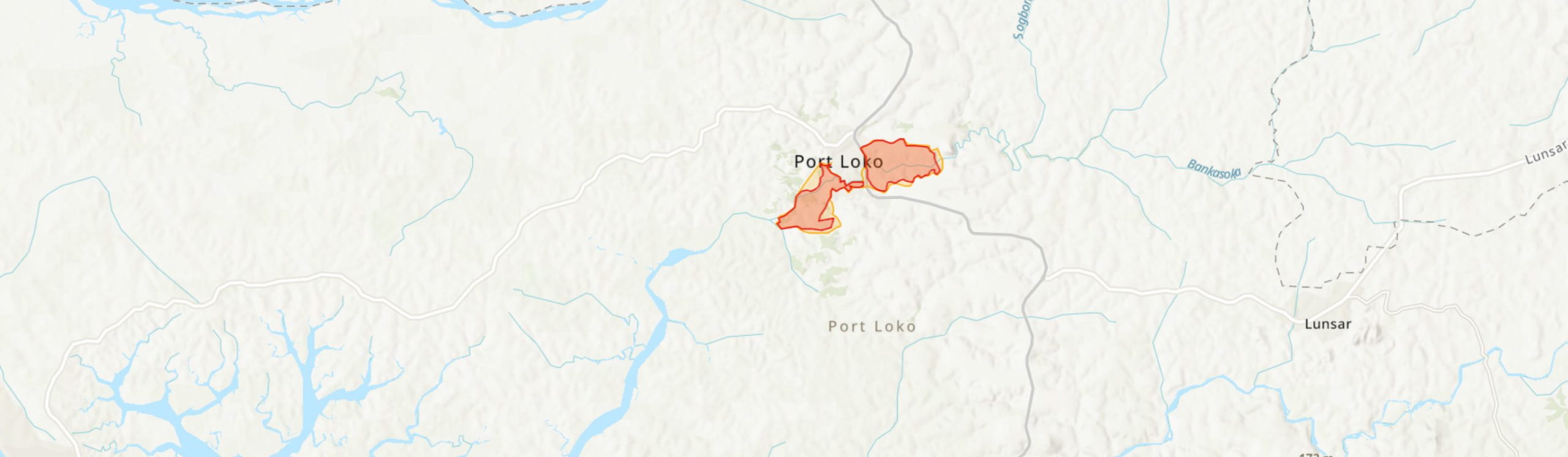
Country: Sierra Leone
Administrative region: Northwestern (Province)
Central co-ordinates: 8.75000 N, 12.8 W
Area: 17.9km²
Qualifying IPA Criteria
A(i)Site contains one or more globally threatened species, C(iii)Site contains nationally threatened or restricted habitat or vegetation types, AND/OR habitats that have severely declined in extent nationally
IPA assessment rationale
The Port Loko forest and wetland complex IPA falls under criterion A(i) as it is the only know site for the Critically Endangered Inversodicraea feika endemic to Sierra Leone and home to three other globally threatened taxa. the site also qualifies under criterion C(iii) due to the presence of the nationally threatened waterfalls and rivers supporting endemic Podostemaceae.
Site description
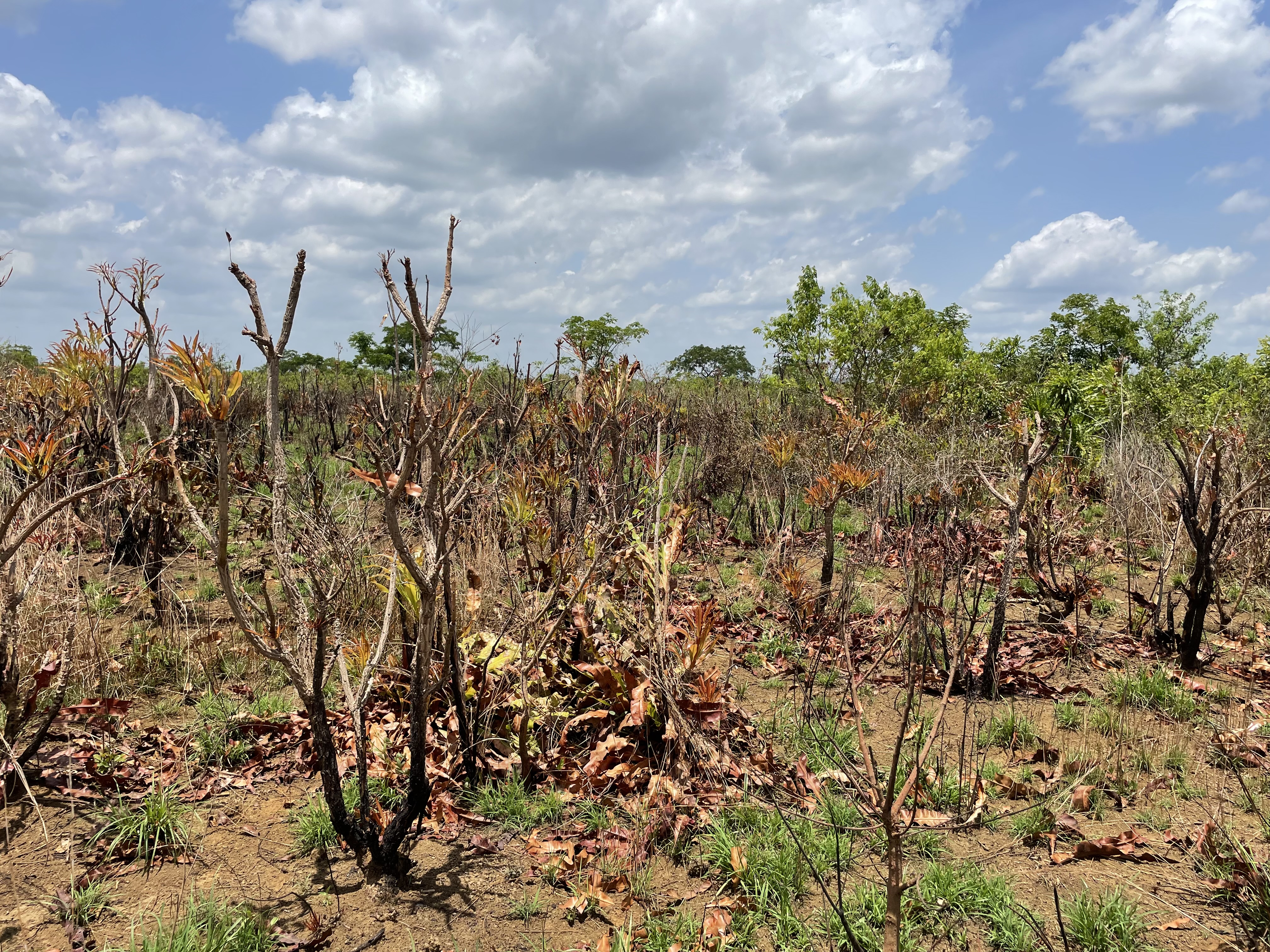
Port Loko Town and its environs are typically flat lands and are characterized by heights between 3m and 75m above sea level in the Northwestern province of Sierra Leone. The Port Loko Forest and Wetlands Complex lies within the transitional zone between the coastal mangroves and the interior forest-savannah mosaic of Sierra Leone. The site includes degraded semi-deciduous forest patches, gallery forests, freshwater swamps, riparian corridors, and seasonally inundated grasslands (Bolilands), embedded within a matrix of agricultural land, and fallow areas.
Despite extensive anthropogenic disturbance resulting in the presence of disturbance-tolerant flora, the site retains a range of ecologically functional habitats that, although degraded, still support rare plant species. The forest patches and wetland margins are particularly important for plant species adapted to seasonal flooding and edaphic variation, while the proximity to the Rokel River and the Scarcies River and their tributaries creates ecological corridors for dispersal.
Botanical significance
The IPA is of high botanical significance due to the presence of four globally threatened and range restricted taxa. Most importantly, it supports the Critically endangered Inversodicraea feika, a rheophytic species endemic to Sierra Leone and currently known only from this IPA making it highly significant for conservation. Additional threatened taxa include the Endangered Pterocarpus erinaceus, the Vulnerable Newtonia elloitii and Lophira alata and the near threatened Psychotria limba.
Habitat and geology
The Port Loko Forest and Wetlands Complex exhibits a high degree of ecological heterogeneity, shaped by both geological and hydrological variability. The landscape consists of a mosaic of secondary forest fragments, wooded savannah, seasonally flooded inland valley swamps, and gallery forests, interspersed with rice paddies, fallow agricultural land, and extensive oil palm-dominated groves (Garriga, 2014).
Freshwater swamp habitats, particularly along the tributaries of the Great and Little Scarcies rivers, support hydrophytic flora such as Raphia palma-pinus and Nymphaea lotus. These swamps function as critical hydrological buffers, regulating seasonal water flows and reducing sedimentation downstream. Gallery forests along riverbanks provide shade-needed and moisture-dependent species and may provide habitat corridors for both plant and animal dispersal across fragmented landscapes.
Coastal and estuarine zones at the western extent of the district are dominated by mangroves and low-lying floodplains. These areas are part of the Bullom-Sherbro wetlands characterized by fine-grained clays, marine sands, and estuarine alluvium, supporting halophytic vegetation and extensive root networks that bind sediments and prevent erosion (Goodenough et al., 2018). The mangrove zones also act as nurseries for fish and crustaceans and contribute to both food security and biodiversity conservation.
The geology of the area, lies on the western edge of the West African Craton within the Rokelide orogenic belt, consists mainly of weathered Precambrian granitic and gneissic rocks (Goodenough et al., 2018). This has resulted in typically acidic, lateritic, and nutrient-poor soils, with more fertile alluvial deposits in valley bottoms supporting swamp formation.
This combination of variable substrates and seasonal hydrology underpins the site's habitat diversity, enabling the persistence of both upland savannah and hydrophilic lowland species within a small geographic area.
Conservation issues
The Port Loko Forest and Wetlands Complex faces multiple, overlapping threats that are degrading its ecological integrity. Agricultural expansion, particularly for rice cultivation, has led to the conversion of inland valley swamps and forest patches into farmland. These changes are exacerbated by unsustainable land-use practices such as slash-and-burn farming and uncontrolled fire use, which impede natural forest regeneration and increase the risk of permanent ecosystem degradation
Between Port Loko District lost over 173,000 hectares of tree cover, accounting for nearly 44% of its forested area. This large-scale deforestation has resulted in substantial carbon emissions and biodiversity loss (Global Forest Watch, 2024).
Mining activities, including both artisanal and industrial extraction of iron ore and rutile, have further degraded terrestrial and freshwater ecosystems through vegetation clearance, soil erosion, and sedimentation of adjacent watercourses (Mabey et al., 2020). In addition, drainage and infilling of freshwater wetlands for infrastructure development and settlement growth continues to reduce critical habitats in this IPA.
Mangrove fringes along the Scarcies River are also under pressure from fuelwood collection and land reclamation. The loss of these habitats reduces coastal resilience and impacts ecosystem services such as fisheries support, and shoreline protection.
Although environmental legislation exists in Sierra Leone, enforcement remains limited, as formal protection within Port Loko area is sparse (Fofanah &Abdulai-Kamara, 2024). Resource management is largely dependent on community-based or customary systems, leaving these ecosystems vulnerable to escalating human pressures.
Ecosystem services
The wetlands of the Port Loko IPA plays a key role in supporting the local livelihood of the local communities particularly through rice farming and the provision of water for agriculture and domestic use all year round. Swamp forest areas help to regulate water flow and reduce downstream flooding, particularly important given the site’s proximity to the Scarcies basin (Garriga, 2014).
The remaining forest patches contributes to soil stabilization and mitigating erosion during the rainy season, while also providing non-timber forest products (NTFPs), including medicinal plants and wild foods (Kargbo et al., 2022). Woodland savanna regions supply several hard wood tree species such as Pterocarpus erinaceus, Parinari excelsa, and Terminalia albida, widely used for charcoal production.
Site assessor(s)
Assessed by:
Fanny Massally, Royal Botanic Gardens, Kew
Date of first assessment: 9th Mar 2026
Reviewed by:Aiah Lebbie, The University of Sierra Leone
IPA criterion A species
| Species | Qualifying sub-criterion | ≥ 1% of global population | ≥ 5% of national population | 1 of 5 best sites nationally | Entire global population | Socio-economically important | Abundance at site |
|---|---|---|---|---|---|---|---|
| Newtonia elliotii (Harms) Keay | A(i) |  |
|
|
|
|
Common |
| Lophira alata Banks ex Gaertn.f. | A(i) | |
|
|
|
|
Occasional |
| Inversodicraea feika | A(i) | |
|
|
|
|
Scarce |
| Pterocarpus erinaceus Poir. | A(i) | |
|
|
|
|
Common |
Newtonia elliotii (Harms) Keay
Qualifying sub-criterion:
A(i)
≥ 1% of global population:
≥ 5% of national population:
1 of 5 best sites nationally:
Entire global population:
Socio-economically important:
Abundance at site:
Common
Lophira alata Banks ex Gaertn.f.
Qualifying sub-criterion:
A(i)
≥ 1% of global population:
≥ 5% of national population:
1 of 5 best sites nationally:
Entire global population:
Socio-economically important:
Abundance at site:
Occasional
Inversodicraea feika
Qualifying sub-criterion:
A(i)
≥ 1% of global population:
≥ 5% of national population:
1 of 5 best sites nationally:
Entire global population:
Socio-economically important:
Abundance at site:
Scarce
Pterocarpus erinaceus Poir.
Qualifying sub-criterion:
A(i)
≥ 1% of global population:
≥ 5% of national population:
1 of 5 best sites nationally:
Entire global population:
Socio-economically important:
Abundance at site:
Common
IPA criterion C qualifying habitats
| Habitat | Qualifying sub-criterion | ≥ 5% of national resource | ≥ 10% of national resource | 1 of 5 best sites nationally | Areal coverage at site |
|---|---|---|---|---|---|
| Waterfalls with endemic Podostemaceae | C(i) |  |
|
|
Waterfalls with endemic Podostemaceae
Qualifying sub-criterion:
C(i)
≥ 5% of national resource:
≥ 10% of national resource:
Areal coverage at site:
General site habitats
| General site habitat | Percent coverage | Importance |
|---|---|---|
| Forest - Subtropical/Tropical Swamp Forest | |
|
| Savanna - Moist Savanna | |
|
| Grassland - Subtropical/Tropical Seasonally Wet/Flooded Lowland Grassland | |
Forest - Subtropical/Tropical Swamp Forest
Percent coverage:
Importance:
Savanna - Moist Savanna
Percent coverage:
Importance:
Grassland - Subtropical/Tropical Seasonally Wet/Flooded Lowland Grassland
Percent coverage:
Importance:
Land use types
| Land use type | Percent coverage | Importance |
|---|---|---|
| Agriculture (pastoral) | |
|
| Agriculture (aquatic) | |
|
| Harvesting of wild resources | |
|
| Extractive industry | |
|
| Residential / urban development | |
|
| Agriculture (arable) | |
Agriculture (pastoral)
Percent coverage:
Importance:
Agriculture (aquatic)
Percent coverage:
Importance:
Harvesting of wild resources
Percent coverage:
Importance:
Extractive industry
Percent coverage:
Importance:
Residential / urban development
Percent coverage:
Importance:
Agriculture (arable)
Percent coverage:
Importance:
Threats
| Threat | Severity | Timing |
|---|---|---|
| Residential & commercial development - Housing & urban areas | High | Ongoing - increasing |
| Agriculture & aquaculture - Annual & perennial non-timber crops - Small-holder farming | High | Ongoing - stable |
| Energy production & mining - Mining & quarrying | High | Ongoing - increasing |
| Biological resource use - Fishing & harvesting aquatic resources - Unintentional effects: subsistence/small scale (species being assessed is not the target) [harvest] | High | Ongoing - stable |
| Biological resource use - Logging & wood harvesting - Intentional use: subsistence/small scale (species being assessed is the target) [harvest] | High | Ongoing - stable |
| Natural system modifications - Dams & water management/use - Small dams | Medium | Future - planned activity |
| Pollution - Domestic & urban waste water | High | Ongoing - stable |
Residential & commercial development - Housing & urban areas
Severity:
High
Timing:
Ongoing - increasing
Agriculture & aquaculture - Annual & perennial non-timber crops - Small-holder farming
Severity:
High
Timing:
Ongoing - stable
Energy production & mining - Mining & quarrying
Severity:
High
Timing:
Ongoing - increasing
Biological resource use - Fishing & harvesting aquatic resources - Unintentional effects: subsistence/small scale (species being assessed is not the target) [harvest]
Severity:
High
Timing:
Ongoing - stable
Biological resource use - Logging & wood harvesting - Intentional use: subsistence/small scale (species being assessed is the target) [harvest]
Severity:
High
Timing:
Ongoing - stable
Natural system modifications - Dams & water management/use - Small dams
Severity:
Medium
Timing:
Future - planned activity
Pollution - Domestic & urban waste water
Severity:
High
Timing:
Ongoing - stable
Management type
| Management type | Description | Year started | Year finished |
|---|---|---|---|
| No management plan in place | |
|
No management plan in place
Year started:
Year finished:
Bibliography
Global Forest Watch
Impact of Charcoal Production on Forest Loss: Case Study of Bo, Moyamba, Port Loko and Tonkolili Districts in Sierra Leone
International Journal of Engineering Research & Technology (IJERT), Vol Vol. 13 Issue 9 (pub. https://www.ijert.org/)


Recommended citation
Fanny Massally (2026) Tropical Important Plant Areas Explorer: Port Loko Forest and Wetlands Complex (Sierra Leone). https://tipas.kew.org/site/port-loko-forest-and-wetlands-complex/ (Accessed on 26/08/2026)