Country: Cameroon
Administrative region: Far North (Region)
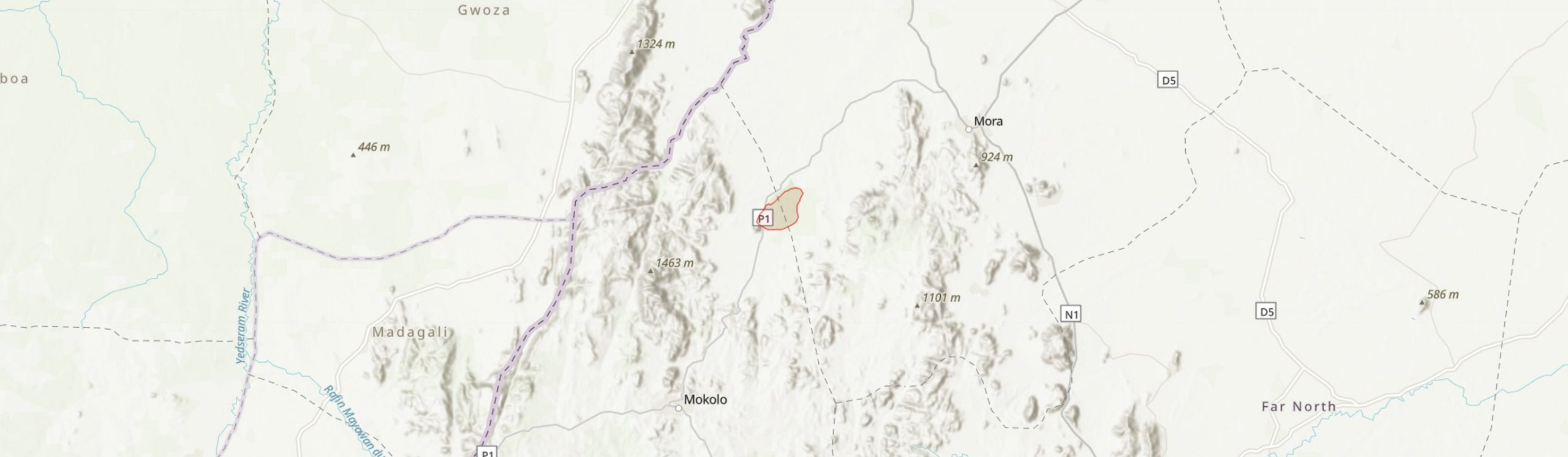
Central co-ordinates: 10.96300 N, 13.92500 E
Area: 17.24km²
Qualifying IPA Criteria
C(iii)Site contains nationally threatened or restricted habitat or vegetation types, AND/OR habitats that have severely declined in extent nationally
IPA assessment rationale
Mozorgo-Gokoro may qualify as an IPA under criterion A(i) through the presence of a few species that are widespread but globally threatened largely due to over-exploitation. However, it may have a stronger case under criterion C as one of the best representative of a nationally threatened habitat type, Sudano-Sahelian dry forest and shrubland.
Site description
Mozogo-Gokoro National Park (MGNP) is within Mayo-Moskota sub-division of Mayo-Tsanaga Division, in the arid Far North Region of Cameroon, quite close to the Nigerian border. It lies between ridges of the Mandara mountains in a relatively low lying valley. The area is stated as 1400 ha by Protected Planet (2021) but their boundary map indicates 1724 ha, which is also given by DOPA (2021). Apparently there is no buffer zone (Sani et al., 2020) so we propose the larger area for the IPA. The Mokolo-Mora road runs along the western boundary of the site, passing through the adjacent town of Mozogo.
The site was established as a forest and wildlife reserve in June 1932 by French colonial decree, making it the oldest protected area in the subsequent nation of Cameroon. It was upgraded to a National Park by the Cameroon government in 1968 (Sani et al., 2019).

Botanical significance
MGNP is visible on satellite imaging as a remarkable green oasis against a background of degraded savanna. Although it is a lowland site and probably not representative of the important plant communities that once characterised upland areas of the Mandara mountains (White, 1983), it is almost unique in this region in its surviving dense canopy forest. Letouzey (1968) and Aubreville (1950) were doubtful that it could be considered primary forest rather than regrowth as a result of the protection it has received for decades (Sani et al., 2020). A contrary view was expressed elsewhere (Delwaulle, 1973). Regardless of the truth, the site provides an enduring example of the type of vegetation that flourishes here when the otherwise intense anthropic pressures are relaxed. The site has apparently been excluded from cutting and burning for many decades (Seymour, 2004).
Sani et al. (2019) recorded 110 species in 46 genera. Three Red List species are present, Khaya senegalensis (VU) Pterocarpus erinaceus (EN) and Afzelia africana (VU). All are wide ranging but assessed on decline largely due to over-exploitation. Pterocarpus erinaceus for example is at the eastern limit of it's range in Cameroon. It is in serious decline due to overharvesting across West Africa where it was previously commonly recorded. It is also slow growing and does not seem be replacing itself (Barstow, 2018). Dalbergia melanoxylon (NT) (also recorded from Waza National Park and Mayo Louti Forest Reserve) is likewise very widespread but slow growing, often poorly regenerating and in serious decline due to exploitation and habitat loss. In Cameroon it is limited to the North and Far North Regions, with few recorded sites (Barstow, 2020). It remains possible that more rare species are present.
Many other economic species that are not threatened occur here. Some of these are at the eastern limit of their range and are likely to have declined heavily in their West African strongholds. Celtis integrifolia (a possible synonym of Celtis toka) for example has been widely recorded in West Africa but is likely to have declined. It is scarcely recorded east of Nigeria.
Habitat and geology
Geologically the site lies at the northwestern edge of an area of plutonic Neo-proterozoic and Cambrian basement rocks, presumably associated with the northern edge of the Congolian craton. This formation abuts the vast Chad basin to the north, where deep Paleogene-Quaternary sediments overlie the pre-Cambrian strata (Thiéblemont et al., 2021). The site is also at the southern edge of where Lake Mega-Chad would have reached until at least 5000 years ago (Armitage et al., 2015; Drake et al., 2022). The climate is semi-arid with a two season rainfall regime influenced by the Mandara mountains to the west which receive c. 1000-1500 mm per annum compared to c.600 mm at Maroua to the east (WMO, 2022). Sani et al. (2019) indicate 800-1000 mm at the site and average annual temperature is 26-28 °C. There is almost no rainfall between November and March. Soils in the area are predominantly free-draining and often infertile regosols, leptosols and luvisols, derived from the granitic mountains and influenced by the arid climate (Yerima & Van Ranst, 2005). Some more fertile clays and other soil types are also present in alluvial areas (Sani et al., 2019; Seymour, 2004).
The site is mapped by Letouzey (1985) as vegetation type 38 "Sahelo-Sudanian (Maroua) and Sudano-Sahelian (Garoua) shrub steppes of degradation, on ± halomorphic (hardy) but often atypical soils." According to the classification of Olson et al. (2001) it is on the border of the Mandara Plateau Mosaic and Sahelian Acacia Savanna ecoregions. Isoberlinia doko woodland is considered to have once been dominant in this area (Seymour, 2004). The arid Sudanian nature of the vegetation is seen in the high proportion of Combretaceae and Leguminosae (Sani et al., 2019). The non-permanent Mayo Nguetchewe flows northward through the eastern part of the site and and Mayo Ngassawe parallels it on the western side
just outside the boundary. These seasonal watercourses (mayos) support denser, higher gallery forest in these parts of the park, with more open forest and thicket in between (Sani et al., 2019).
Conservation issues
MGNP is one of three national parks in the Far North region. Legal protection, combined possibly with some natural protection from dominant thorny species (Senegalia ataxacantha) and local respect for forest conservation and taboos, appear to have successfully limited human impacts (Sani et al., 2019; Seymour, 2004). This can be verified from up to date satellite imaging (Global Forest Watch, 2022). Yengue (2000) suggests it is the only protected area in good condition in the Far North region. Sani et al. (2019) describe it as a model of conservation in the Sudano-Sahelian part of Cameroon.
Conservation concerns are, however, numerous. Fire, wood-gathering and grazing are the main threats (Seymour, 2022), resulting in the starkly different vegetation outside the park. Substantial wood extraction from within the park does appear to take place and it may be that partial use of non-destructive practices such as pollarding limit the extent of degradation. Local population density is high, exceeding 300 people per km2. There is no demarcated border zone or management plan. The Boko-Harem are active in the Mandara mountains making the site largely out of bounds for conservation workers. Introduced species such as Azadirachta indica are also a potential threat (Sani et al., 2020). Local fire dynamics may need to be studied to ensure that long-term fire prevention does not result in hotter more damaging burns (Seymour, 2004).
Ecosystem services
The site provides wood and medicinal plants to the local people (Todou et al., 2019). It is an important reservoir of genes and source of propagules for timber and other species in an area where almost no forest remains. Various fauna including Python sebae (NT) are recorded (Seymour, 2004)
Site assessor(s)
Bruce Murphy, Royal Botanic Gardens, Kew
IPA criterion A species
| Species | Qualifying sub-criterion | ≥ 1% of global population | ≥ 5% of national population | 1 of 5 best sites nationally | Entire global population | Socio-economically important | Abundance at site |
|---|---|---|---|---|---|---|---|
| Pterocarpus erinaceus Poir. | A(i) |  |
 |
|
|
|
|
| Khaya senegalensis A.Juss. | A(i) | |
|
|
|
|
|
| Afzelia africana Sm. ex Pers. | A(i) | |
|
|
|
|
|
| Stereospermum melanoxylum Cham. | A(iii) | |
|
|
|
|
Pterocarpus erinaceus Poir.
Qualifying sub-criterion:
A(i)
≥ 1% of global population:
≥ 5% of national population:
1 of 5 best sites nationally:
Entire global population:
Socio-economically important:
Abundance at site:
Khaya senegalensis A.Juss.
Qualifying sub-criterion:
A(i)
≥ 1% of global population:
≥ 5% of national population:
1 of 5 best sites nationally:
Entire global population:
Socio-economically important:
Abundance at site:
Afzelia africana Sm. ex Pers.
Qualifying sub-criterion:
A(i)
≥ 1% of global population:
≥ 5% of national population:
1 of 5 best sites nationally:
Entire global population:
Socio-economically important:
Abundance at site:
Stereospermum melanoxylum Cham.
Qualifying sub-criterion:
A(iii)
≥ 1% of global population:
≥ 5% of national population:
1 of 5 best sites nationally:
Entire global population:
Socio-economically important:
Abundance at site:
General site habitats
| General site habitat | Percent coverage | Importance |
|---|---|---|
| Forest - Subtropical/Tropical Dry Forest | 100 |
Forest - Subtropical/Tropical Dry Forest
Percent coverage:
100
Importance:
Land use types
| Land use type | Percent coverage | Importance |
|---|---|---|
| Nature conservation | 100 | Major |
Nature conservation
Percent coverage:
100
Importance:
Major
Threats
| Threat | Severity | Timing |
|---|---|---|
| Agriculture & aquaculture - Annual & perennial non-timber crops - Small-holder farming | Low | Future - inferred threat |
| Agriculture & aquaculture - Livestock farming & ranching - Nomadic grazing | Low | Ongoing - trend unknown |
| Biological resource use - Gathering terrestrial plants - Intentional use (species being assessed is the target) | Low | Ongoing - trend unknown |
| Biological resource use - Logging & wood harvesting | Medium | Ongoing - trend unknown |
| Natural system modifications - Fire & fire suppression - Increase in fire frequency/intensity | Low | Ongoing - trend unknown |
| Invasive & other problematic species, genes & diseases - Invasive non-native/alien species/diseases | Low | Ongoing - increasing |
| Human intrusions & disturbance - War, civil unrest & military exercises | Medium | Ongoing - trend unknown |
Agriculture & aquaculture - Annual & perennial non-timber crops - Small-holder farming
Severity:
Low
Timing:
Future - inferred threat
Agriculture & aquaculture - Livestock farming & ranching - Nomadic grazing
Severity:
Low
Timing:
Ongoing - trend unknown
Biological resource use - Gathering terrestrial plants - Intentional use (species being assessed is the target)
Severity:
Low
Timing:
Ongoing - trend unknown
Biological resource use - Logging & wood harvesting
Severity:
Medium
Timing:
Ongoing - trend unknown
Natural system modifications - Fire & fire suppression - Increase in fire frequency/intensity
Severity:
Low
Timing:
Ongoing - trend unknown
Invasive & other problematic species, genes & diseases - Invasive non-native/alien species/diseases
Severity:
Low
Timing:
Ongoing - increasing
Human intrusions & disturbance - War, civil unrest & military exercises
Severity:
Medium
Timing:
Ongoing - trend unknown
Protected areas
| Protected area name | Protected area type | Relationship with IPA | Areal overlap |
|---|---|---|---|
| Mozogo-Gokoro National Park | National Park | protected/conservation area matches IPA | |
Mozogo-Gokoro National Park
Protected area type:
National Park
Relationship with IPA:
protected/conservation area matches IPA
Areal overlap:
Management type
| Management type | Description | Year started | Year finished |
|---|---|---|---|
| No management plan in place | |
|
No management plan in place
Year started:
Year finished:
Bibliography
Notice de la carte phytogéographique du Cameroun au 1: 500,000.
The vegetation of Africa. A descriptive memoir to accompany the UNESCO/AETFAT/UNSO vegetation map of Africa
Terrestrial ecoregions of the world: a new map of life on earth
Bioscience, Vol 51, page(s) 3-938
Major Soil Classification Systems Used in the Tropics: Soils of Cameroon
Désertification de l’Afrique au Sud du Sahara.
Bois et Forêts des Tropiques, Vol 149, page(s) 3-20
West African monsoon dynamics inferred from abrupt fluctuations of Lake Mega-Chad
Proceedings of the National Academy of Sciences, Vol 112(28), page(s) 8543–8548
Geological Map of Africa at 1:10 M scale, CGMW-BRGM 2016
Flore forestière soudano-guinéenne : A.O.F., Cameroun, A.E.F.
Pterocarpus erinaceus. The IUCN Red List of Threatened Species 2018: e.T62027797A62027800.
Dalbergia melanoxylon. The IUCN Red List of Threatened Species 2020: e.T32504A67798379.
Mandara Plateau Ecoregion
Mandara Plateau Mosaic
Phytoecological valorization attributes of Mozogo-Gokoro National Park (Cameroon)
Environ Monit Assess, Vol 191(2), page(s) 79
Sustainable Management of Tropical Dry Forests: An Overview from Cameroonian Context and the Special Case of Mozogo-Gokoro National Park
Natural Resources Management and Biological Sciences (pub. IntechOpen)
Ethnobotanical study of indigenous woody plants in traditional agroforestry of the Sudano-Sahelianzone of Cameroon: case of Mandara Mountains
SSRG International Journal of Agriculture & Environmental Science, Vol 6(6), page(s) 1-8
Sedimentary and geomorphic evidence of Saharan megalakes: A synthesis
Quaternary Science Reviews, Vol 276: 107318


Recommended citation
Bruce Murphy (2024) Tropical Important Plant Areas Explorer: Mozogo-Gokoro National Park (Cameroon). https://tipas.kew.org/site/mozogo-gokoro-national-park/ (Accessed on 27/07/2024)