Country: Ethiopia
Administrative region: Somali (Regional State)
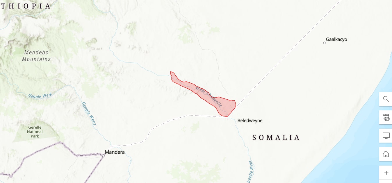
Central co-ordinates: 5.49616 N, 44.34613 E
Area: 4935km²
Qualifying IPA Criteria
A(i)Site contains one or more globally threatened species
IPA assessment rationale
The Lower Wabi Shebelle qualifies as an IPA under criterion A(i) due to the presence of eight globally threatened species. The IPA is a key locality for Boswellia ogadensis (CR), Euphorbia piceoides (CR), Euphorbia suborbicularis (CR), Kleinia isabellae (CR), Senegalia pseudonigrescens (CR), Euphorbia ogadenensis (EN), Orthosiphon grandiflorus (EN) and Blepharis gypsophila (VU). At least seven of these species are only known to occur within the IPA, suggesting high site irreplaceability. The eighth (Senegalia pseudonigrescens) has one potential occurrence record just north of the IPA, although there are no herbarium vouchers to support this human observation. Either way, this site also represents a globally important locality for Senegalia pseudonigrescens. Further research is needed to understand the range of Cordeauxia edulis (EN) and confirm its presence in this IPA. Livestock overgrazing, population growth and agricultural development schemes all pose significant threats to these species and the area's wider vegetation and natural habitats.
Site description
The Lower Wabi Shebelle IPA is situated in the Harerege and Bale floristic regions of Somali Regional State, in the southeast Ethiopian lowlands (Friis et al., 2010). The Wabi Shebelle River originates in the Bale Mountains and is one the country's major rivers. In the eastern part of the IPA, the Ferfer River (the main seasonal tributary) joins the Wabi Shebelle River (BirdLife, 2024). The IPA also encompasses a number of towns and villages, including Kelafo and Mustahil, and borders the town of Gode to the west and the national border with Somalia to the east. The Wabi Shebelle River actually extends into Somalia towards Mogadishu, before turning south and, during seasonally wet periods, joining the Jubba River near its mouth in southern Somalia.
Botanical significance
The Ogaden region, within which the Lower Wabi Shebelle IPA resides, is one of the most floristically underexplored areas in Ethiopia due to accessibility and security issues over recent decades, attributable to drought, famine, violence and other socio-political tensions (Mabberley, 2009; Majid et al., 2022). The IPA and its surrounding areas are thought to have a high potential for the discovery of new endemic species, especially succulent species and those associated with gypsum and limestone outcrops (Sebsebe & Dioli, 2000; Thulin & Vollesen, 2015). In the Ogaden region, the abundance and diversity of endemic floristic species is thought to be relatively high compared to other regions in Ethiopia (Thulin, 2011; cited in Thulin & Vollesen, 2015).
Despite the lack of botanical exploration across the region, the Lower Wabi Shebelle IPA is known to be a key locality for eight globally threatened endemic species, namely the tree species, Boswellia ogadensis (CR), Euphorbia piceoides (CR), Senegalia (Acacia) pseudonigrescens (CR) and Euphorbia ogadenensis (EN), the shrubs, Kleinia isabellae (CR) and Blepharis gypsophila (VU), and the subshrubs, Euphorbia suborbicularis (CR) and Orthosiphon grandiflorus (EN). The IPA is thus an important site for five Critically Endangered species and the only known locality for seven of the eight globally threatened species. Given the lack of botanical exploration in the region, however, further fieldwork campaigns could reveal a more widespread distribution for some of these species (Dioli, 2002; Thulin, 2009; Thulin & Vollesen, 2015).
The globally threatened and socio-economically important endemic evergreen shrub species, Cordeauxia edulis (EN), was also noted in the KBA and IBA assessments of the Lower Wabi Shebelle River and Warder, although it is likely present in Warder rather than along the Lower Wabi Shebelle River (Key Biodiveristy Areas, 2024; BirdLife, 2024). The presence of Cordeauxia edulis thus needs to be confirmed as its natural distribution is not thought to extend as far south as the Wabi Shebelle region (Yusuf et al., 2013), and there are no supporting herbarium vouchers within the IPA. Also of note is the locally abundant endemic tree, Acacia fumosa (LC), which is believed to occur within the IPA (Thulin & Vollesen, 2015).
Habitat and geology
The IPA is characterised by arid lowlands, as well as floodplains and seasonal tributaries associated with the Wabi Shebelle river (BirdLife, 2024). Friis et al. (2010) categorised the Wabi Shebelle Valley as desert and semi-desert scrubland with intermittent wetlands and salt-lake shore vegetation, dominated by drought-tolerant species (Asefa et al., 2020). Land cover within the IPA consists of Acacia-Commiphora deciduous bushland and thickets, grassland, rocky limestone and gypsum outcrops, succulent scrub, wetlands, irrigated agricultural fields and urban areas (Thulin, 2009; Thulin & Vollesen, 2015; Friis et al., 2016). Periodic flooding occurs between Kelafo and Ferfer about twice a year, forming a large flood zone (Segalen, 1973; De Sole et al., 1978; BirdLife, 2024).
Frequently encountered flora include the tree and shrub species, Acacia fumosa, Cadaba divaricata, Gossypium bricchettii, Jatropha rivae, Pleuropterantha revoilii and several species of Commiphora, the succulent subshrub, Euphorbia polyantha, and the perennial herb, Indigofera gypsacea (Segalen, 1973; Thulin, 2009; Thulin & Vollesen, 2015). Additionally, the Ferfer and Mustahil woredas (districts), located in the eastern part of the IPA, contain a halophytic community of Bolboschoenus maritimus, Cenchrus biflorus, Cucumis kelleri and Urochondra setulosa (Segalen, 1973; BirdLife, 2024). Grass species dominate the floodplains (BirdLife, 2024).
The lithology of the area is characterised by sedimentary rock dating back to the Early Cretaceous, mainly Korahe gypsum and Mustahil limestone (Persits et al., 2002; JICA, 2013). The gypsum outcrops form flat to undulating land, intersected by a network of rivers and streams, while alluvial deposits are found throughout the IPA (Segalen, 1973; JICA, 2013; BirdLife, 2024). Soils are predominantly calcaric fluvisols, haplic calcisols and haplic gypsisols, although leptisols and vertisols also occur (Jones et al., 2013). The Wabi Shebelle River reportedly has a high saline content (Mohamed, 2013), and salt tends to accumulate in the drier areas of the IPA, between Kelafo and Ferfer (Segalen, 1973).
The climate of the Lower Wabi Shebelle region is arid. The mean annual temperature for Gode is 28 C, with an average humidity of 55% (Segalen, 1973; De Sole et al., 1978). Rainfall is bimodal with two rainy seasons in March-May and October-November (De Sole et al., 1978). Mean annual rainfall varies across the IPA, ranging from 170-210 mm at Kelafo to 335 mm at Gode (Bauduin, 1973; Segalen, 1973).
Conservation issues
There is currently no site protection or management plan in place within the IPA. The IPA overlaps with the eastern section of the Lower Wabi Shebelle and Warder Important Bird Area (IBA) and Key Biodiversity Area (KBA). The IBA was identified under criteria A1, A2 and A3, due to the occurrence of 47 bird species, all now categorised as Least Concern on the IUCN Red List, with the exception of Heterotetrax humilis (little brown bustard, NT), Streptopelia reichenowi (white-winged collared dove, NT) and Sylvietta philippae (Philippa's crombec, DD) (BirdLife, 2024). Its KBA status was determined based on the IBA assessment and is a priority for reassessment under the current Global KBA Standard, since it has not been evaluated since its original assessment in 1996 (Key Biodiversity Areas, 2024).
As aforementioned, the IPA and wider Ogaden region have been underexplored floristically due to relative inaccessibility, caused by poor infrastructure and security issues (Sebsebe & Dioli, 2000; Mabberley, 2009). Severe droughts, floods, periodic famine, territorial wars and a tense political climate have all contributed to socio-political instability in the region (Hogg, 1991; Mohamed & Iman, 2010; Mohamed, 2013; OCHA, 2020), unsurprisingly inhibiting conservation efforts. Pastoralism is the primary livelihood and income-generating activity in the area, resulting in overgrazing by livestock and natural habitat degradation across the IPA (Thulin & Vollesen, 2015). The main livestock are cattle, sheep, goats, and camels (De Sole et al., 1978). The threatened endemics of the IPA are vulnerable to this intense grazing pressure (Alemu et al., 2018a, 2018b, 2018c; Nemomissa et al., 2018).
Other potential threats to the Lower Wabi Shebelle IPA and its flora include agricultural development schemes and increasing populations (Key Biodiversity Areas, 2024; BirdLife, 2024). Irrigation along the Wabi Shebelle River began in the 1960s, coinciding with the creation of a research centre aiming to assess the ‘suitability for large-scale irrigated crop farming’ (Livestock, Crop and Rural Development Bureau, 2013). Irrigation in the 1960s and 1970s was mainly limited to the Kelafo region, downstream from Gode (Bauduin, 1973), but increased under the Derg regime (Livestock, Crop and Rural Development Bureau, 2013). Now, irrigated agricultural fields can be observed all along the Wabi Shebelle River, aided by diesel pumps (Livestock, Crop and Rural Development Bureau, 2013). A large scale, government run, gravity irrigation scheme in West Gode was established in the early 2000s. Construction began during the mid 1990s, with 1000 ha developed by 2001 and a further 2000 ha by 2006 (Livestock, Crop and Rural Development Bureau, 2013). Crop diversification was introduced in 2008, however by 2010 production had declined due to high levels of siltation and canal damage, resulting in the scheme being suspended. In 2013, the Somali Regional State government made plans to revive the West Gode gravity irrigation project, although the current status of the project is unclear.
In 2001, a dam was constructed near Gode as part of irrigation development (Mohamed & Iman, 2010). According to Mohamed (2014), future major development plans for the Wabi Shebelle River include 141 irrigation schemes and six large dams as part of the Wabi Shebelle River Basin Master Plan (2005-2035). The irrigation potential of the Wabi Shebelle River has been estimated to be 204,000 ha (Mohamed, 2013).
Ecosystem services
The ecosystem services provided by this site are not well documented. The area is mainly used as a source of water for crop irrigation along the river, the main crops being sorghum, maize, onion, and sesame (De Sole et al., 1978; Livestock, Crop and Rural Development Bureau, 2013; Mohamed, 2013). The Wabi Shebelle River has many important downstream uses in Somalia as a water source for local communities, agricultural developments, and recharging groundwater aquifers (Mohamed, 2013). In years with exceptionally heavy rain the Wabi Shebelle reaches the Indian Ocean, although the river usually dries up in the southern Somalia desert (Mohamed, 2013). There is no known tourism within the IPA and this is unlikely to change until the region is politically stable and readily accessible. However, Teshale (2020) highlights the site's tourism potential, not least given its diversity of uncommon and range restricted bird species. The Ogaden region is also reported to contain natural resources such as minerals and natural gas (Mohamed, 2013).
Site assessor(s)
Joe Langley, Royal Botanic Gardens, Kew
Eden House, Royal Botanic Gardens, Kew
Iain Darbyshire, Royal Botanic Gardens, Kew
Sebsebe Demissew, Addis Ababa University
Sileshi Nemomissa, Addis Ababa University
Ermias Lulekal, Addis Ababa University
IPA criterion A species
| Species | Qualifying sub-criterion | ≥ 1% of global population | ≥ 5% of national population | 1 of 5 best sites nationally | Entire global population | Socio-economically important | Abundance at site |
|---|---|---|---|---|---|---|---|
| Boswellia ogadensis Vollesen | A(i) |  |
|
|
|
 |
Unknown |
| Acacia pseudonigrescens Brenan & J.H.Ross | A(i) | |
|
|
|
|
Unknown |
| Euphorbia ogadenensis P.R.O.Bally & S.Carter | A(i) | |
|
|
|
|
Unknown |
| Euphorbia piceoides Thulin | A(i) | |
|
|
|
|
Unknown |
| Kleinia isabellae Dioli & Mesfin | A(i) | |
|
|
|
|
Unknown |
| Euphorbia suborbicularis Thulin | A(i) | |
|
|
|
|
Unknown |
| Orthosiphon grandiflorus A.Terracc. | A(i) | |
|
|
|
|
Unknown |
| Blepharis gypsophila Thulin & Vollesen | A(i) | |
|
|
|
|
Unknown |
Boswellia ogadensis Vollesen
Qualifying sub-criterion:
A(i)
≥ 1% of global population:
≥ 5% of national population:
1 of 5 best sites nationally:
Entire global population:
Socio-economically important:
Abundance at site:
Unknown
Acacia pseudonigrescens Brenan & J.H.Ross
Qualifying sub-criterion:
A(i)
≥ 1% of global population:
≥ 5% of national population:
1 of 5 best sites nationally:
Entire global population:
Socio-economically important:
Abundance at site:
Unknown
Euphorbia ogadenensis P.R.O.Bally & S.Carter
Qualifying sub-criterion:
A(i)
≥ 1% of global population:
≥ 5% of national population:
1 of 5 best sites nationally:
Entire global population:
Socio-economically important:
Abundance at site:
Unknown
Euphorbia piceoides Thulin
Qualifying sub-criterion:
A(i)
≥ 1% of global population:
≥ 5% of national population:
1 of 5 best sites nationally:
Entire global population:
Socio-economically important:
Abundance at site:
Unknown
Kleinia isabellae Dioli & Mesfin
Qualifying sub-criterion:
A(i)
≥ 1% of global population:
≥ 5% of national population:
1 of 5 best sites nationally:
Entire global population:
Socio-economically important:
Abundance at site:
Unknown
Euphorbia suborbicularis Thulin
Qualifying sub-criterion:
A(i)
≥ 1% of global population:
≥ 5% of national population:
1 of 5 best sites nationally:
Entire global population:
Socio-economically important:
Abundance at site:
Unknown
Orthosiphon grandiflorus A.Terracc.
Qualifying sub-criterion:
A(i)
≥ 1% of global population:
≥ 5% of national population:
1 of 5 best sites nationally:
Entire global population:
Socio-economically important:
Abundance at site:
Unknown
Blepharis gypsophila Thulin & Vollesen
Qualifying sub-criterion:
A(i)
≥ 1% of global population:
≥ 5% of national population:
1 of 5 best sites nationally:
Entire global population:
Socio-economically important:
Abundance at site:
Unknown
General site habitats
| General site habitat | Percent coverage | Importance |
|---|---|---|
| Wetlands (inland) - Permanent Rivers, Streams, Creeks [includes waterfalls] | |
Major |
| Shrubland - Subtropical/Tropical Dry Shrubland | |
Major |
| Grassland - Subtropical/Tropical Dry Lowland Grassland | |
Major |
| Artificial - Terrestrial - Urban Areas | |
Minor |
| Artificial - Terrestrial - Arable Land | |
Major |
| Artificial - Terrestrial - Pastureland | |
Major |
| Rocky Areas | |
Major |
| Desert - Hot Desert | |
Major |
| Grassland - Subtropical/Tropical Seasonally Wet/Flooded Lowland Grassland | |
Major |
Wetlands (inland) - Permanent Rivers, Streams, Creeks [includes waterfalls]
Percent coverage:
Importance:
Major
Shrubland - Subtropical/Tropical Dry Shrubland
Percent coverage:
Importance:
Major
Grassland - Subtropical/Tropical Dry Lowland Grassland
Percent coverage:
Importance:
Major
Artificial - Terrestrial - Urban Areas
Percent coverage:
Importance:
Minor
Artificial - Terrestrial - Arable Land
Percent coverage:
Importance:
Major
Artificial - Terrestrial - Pastureland
Percent coverage:
Importance:
Major
Rocky Areas
Percent coverage:
Importance:
Major
Desert - Hot Desert
Percent coverage:
Importance:
Major
Grassland - Subtropical/Tropical Seasonally Wet/Flooded Lowland Grassland
Percent coverage:
Importance:
Major
Land use types
| Land use type | Percent coverage | Importance |
|---|---|---|
| Agriculture (arable) | |
Major |
| Agriculture (pastoral) | |
Major |
| Residential / urban development | |
Minor |
Agriculture (arable)
Percent coverage:
Importance:
Major
Agriculture (pastoral)
Percent coverage:
Importance:
Major
Residential / urban development
Percent coverage:
Importance:
Minor
Threats
| Threat | Severity | Timing |
|---|---|---|
| Agriculture & aquaculture - Livestock farming & ranching - Nomadic grazing | High | Ongoing - trend unknown |
| Agriculture & aquaculture - Livestock farming & ranching - Small-holder grazing, ranching or farming | High | Ongoing - trend unknown |
| Agriculture & aquaculture - Annual & perennial non-timber crops | Unknown | Ongoing - increasing |
| Climate change & severe weather - Droughts | Unknown | Ongoing - trend unknown |
| Natural system modifications - Dams & water management/use | Medium | Ongoing - trend unknown |
| Human intrusions & disturbance - War, civil unrest & military exercises | Unknown | Past, not likely to return |
Agriculture & aquaculture - Livestock farming & ranching - Nomadic grazing
Severity:
High
Timing:
Ongoing - trend unknown
Agriculture & aquaculture - Livestock farming & ranching - Small-holder grazing, ranching or farming
Severity:
High
Timing:
Ongoing - trend unknown
Agriculture & aquaculture - Annual & perennial non-timber crops
Severity:
Unknown
Timing:
Ongoing - increasing
Climate change & severe weather - Droughts
Severity:
Unknown
Timing:
Ongoing - trend unknown
Natural system modifications - Dams & water management/use
Severity:
Medium
Timing:
Ongoing - trend unknown
Human intrusions & disturbance - War, civil unrest & military exercises
Severity:
Unknown
Timing:
Past, not likely to return
Conservation designation
| Designation name | Protected area | Relationship with IPA | Areal overlap |
|---|---|---|---|
| Lower Wabi Shebelle River and Warder IBA | Important Bird Area | protected/conservation area overlaps with IPA | 4398 |
| Lower Wabi Shebelle River and Warder KBA | Key Biodiversity Area | protected/conservation area overlaps with IPA | 4398 |
Lower Wabi Shebelle River and Warder IBA
Protected area:
Important Bird Area
Relationship with IPA:
protected/conservation area overlaps with IPA
Areal overlap:
4398
Lower Wabi Shebelle River and Warder KBA
Protected area:
Key Biodiversity Area
Relationship with IPA:
protected/conservation area overlaps with IPA
Areal overlap:
4398
Management type
| Management type | Description | Year started | Year finished |
|---|---|---|---|
| No management plan in place | |
|
No management plan in place
Year started:
Year finished:
Bibliography
Soil Atlas of Africa
Atlas of the Potential Vegetation of Ethiopia.
Boswellia ogadensis. The IUCN Red List of Threatened Species 2018: e.T34385A128140745
Euphorbia ogadenensis. The IUCN Red List of Threatened Species 2018: e.T34387A128380167
Euphorbia piceoides. The IUCN Red List of Threatened Species 2018: e.T128045317A128045327
Ethiopian vegetation types, climate and topography
Plant Diversity, Vol 42, page(s) 302-311
Wabi Shebelle Survey: Hydrological Survey of the Wabi Shebelle Basin.
Important Bird Areas factsheet: Lower Wabi Shebelle river and Warder
Two new species of Pseudolithos P. R. O. Bally (Apocynaceae-Asclepiadoideae) from the Horn of Africa
Kew Bulletin, Vol 57, page(s) 985-988
Two distinctive new species of Commicrapus (Nyctaginaceae) from gypsum outcrops in eastern Ethiopia
Kew Bulletin, Vol 72, page(s) 34
Famine in the Ogaden
Disasters, Vol 15(3), page(s) 271-273
The Study on Jarar Valley and Shebele Sub-basin Water Supply Development Plan, and Emergency Water Supply in the Federal Democratic Republic of Ethiopia. Final Report (2/7), Volume 1: Survey on the potential water resources (groundwater) utilization
Key Biodiversity Areas factsheet: Lower Wabi Shebelle river and Warder
The Lower Shebelle Irrigation Scheme in Ethiopia: An assessment of productive options
Exploring Terra Incognita
Science, Vol 324, page(s) 472
Managing shared river basins in the Horn of Africa: Ethiopian planned water projects on the Juba and Shabelle rivers and effects on downstream uses in Somalia
WIT Transactions on Ecology and The Environment, Vol 172, page(s) 139-151
Comparing Africa’s Shared River Basins – The Limpopo, Orange, Juba and Shabelle Basins
Universal Journal of Geoscience, Vol 2(7), page(s) 200-211
‘Hydropolitics in the Horn of Africa: Conflicts and Cooperation in the Juba and Shabelle Rivers.’ in Calas, B. & Martinon, C.A.M. Shared Waters, Sharded Opportunities: Hydropolitics in East Africa
Acacia pseudonigrescens. The IUCN Red List of Threatened Species 2018: e.T34388A128446172
Ethiopia: Floods. Situation Report
Map showing geology, oil and gas fields and geologic provinces of Africa, Ver 2.0. USGS Open File report 97-470 A
Wabi Shebelle Survey: The Soils of the Wabi Shebelle Basin
Schistosoma haematobium in the Wabi Shebelle Valley of Ethiopia
American Journal of Tropical Medicine and Hygiene, Vol 27(5), page(s) 928-930
Tourism Potentials and Challenges of the Somali Region, Ethiopia
Journal of Tourism & Hospitality, Vol 9, page(s) 447
New species of Euphorbia (Euphorbiaceae) from eastern Ethiopia
Kew Bulletin, Vol 64, page(s) 469
Blepharis gypsophila (Acanthaceae), a new species from Ethiopia
Kew Bulletin, Vol 70, page(s) 26
The decline of the Vulnerable yeheb Cordeauxia edulis, an economically important dryland shrub of Ethiopia
Oryx, Vol 47(1), page(s) 54-58
Ethiopia’s Somali region: between drought and unrest
A new Aloe (Aloaceae) species from the Ogaden (Southeastern Ethiopia)
Kew Bulletin, Vol 55, page(s) 679-682


Recommended citation
Joe Langley, Eden House, Iain Darbyshire, Sebsebe Demissew, Sileshi Nemomissa, Ermias Lulekal (2024) Tropical Important Plant Areas Explorer: Lower Wabi Shebelle (Ethiopia). https://tipas.kew.org/site/lower-wabi-shebelle/ (Accessed on 27/07/2024)