Country: British Virgin Islands
Administrative region: Ginger (Province)
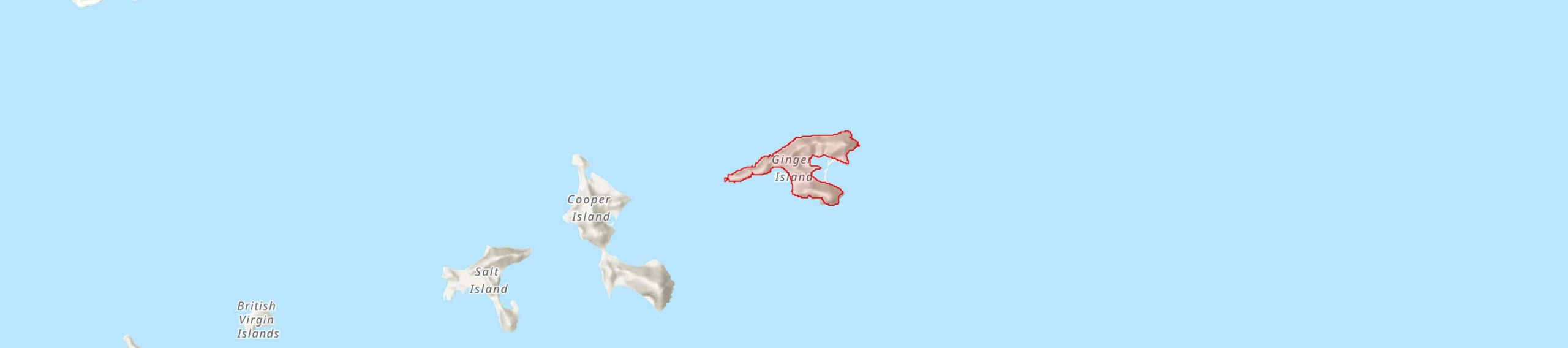
Central co-ordinates: 18.38875 N, 64.47951 W
Area: 0.99km²
Qualifying IPA Criteria
A(i)Site contains one or more globally threatened species, C(iii)Site contains nationally threatened or restricted habitat or vegetation types, AND/OR habitats that have severely declined in extent nationally
IPA assessment rationale
The whole island has been identified as a TIPA for its important Coastal shrubland habitat and for being one of the five best sites for two globally threatened Puerto Rican Bank endemic plants. Mangroves and Dry salt flats, which occur in small areas around a salt pond on the South Bay side, did not qualify for the TIPAs criteria because of their small size and lesser importance at a national level.
Site description
The whole island has been identified as a TIPA. This island is one of the few privately owned uninhabited and undeveloped islands in the territory.
Botanical significance
The area around Wedgeo Bay has important populations of the Puerto Rican Bank endemics Bastardiopsis eggersii (EN) and Malpighia woodburyana (VU); being one of the five-best sites in the BVI for these two species and qualifying the area under TIPAs sub-criterion A(i). The Greater Antilles endemic cactus Stenocereus fimbriatus (LC), which is locally rare, has also been recorded in this TIPA.
Habitat and geology
The elevation varies from sea level to just over 100m on this volcanic island, with large parts of the coast being rocky and steep with sparse vegetation. Large tracts of Coastal shrubland cover more than a quarter of this island’s surface and it has been assessed as the third-best site for this habitat in the BVI. The other two nationally threatened habitats present here are Mangroves and Dry salt flats, which occur in small areas around a salt pond on the South Bay side. There are also large areas of Seasonally deciduous forest and woodland on the island.
Conservation issues
The main threats to this TIPA are future development, invasive plants and feral goats if they are reintroduced.
Ecosystem services
Ginger Island was declared a Bird Sanctuary in 1959. Some of the surrounding marine environment was declared a Fisheries Protected Area in 2003 and there are two proposed Marina Protected Areas around this island.
Site assessor(s)
BVI TIPAs National Team, Royal Botanic Gardens, Kew - National Parks Trust of the Virgin Islands - BVI Ministry of Natural Resources, Labour and Immigration
IPA criterion A species
| Species | Qualifying sub-criterion | ≥ 1% of global population | ≥ 5% of national population | 1 of 5 best sites nationally | Entire global population | Socio-economically important | Abundance at site |
|---|---|---|---|---|---|---|---|
| Bastardiopsis eggersii (Baker f.) Fuertes & Fryxell | A(i) |  |
|
 |
|
|
|
| Malpighia woodburyana Vivaldi | A(i) | |
|
|
|
|
Bastardiopsis eggersii (Baker f.) Fuertes & Fryxell
Qualifying sub-criterion:
A(i)
≥ 1% of global population:
≥ 5% of national population:
1 of 5 best sites nationally:
Entire global population:
Socio-economically important:
Abundance at site:
Malpighia woodburyana Vivaldi
Qualifying sub-criterion:
A(i)
≥ 1% of global population:
≥ 5% of national population:
1 of 5 best sites nationally:
Entire global population:
Socio-economically important:
Abundance at site:
IPA criterion C qualifying habitats
| Habitat | Qualifying sub-criterion | ≥ 5% of national resource | ≥ 10% of national resource | 1 of 5 best sites nationally | Areal coverage at site |
|---|---|---|---|---|---|
| Coastal Shrubland | C(iii) | |
|
|
Coastal Shrubland
Qualifying sub-criterion:
C(iii)
≥ 5% of national resource:
≥ 10% of national resource:
Areal coverage at site:
Bibliography
Identifying and Conserving Tropical Important Plant Areas in the British Virgin Islands (2016-2019): Final Technical Report


Recommended citation
BVI TIPAs National Team (2024) Tropical Important Plant Areas Explorer: Ginger Island (British Virgin Islands). https://tipas.kew.org/site/ginger-island/ (Accessed on 27/07/2024)
Acknowledgement
Map of the BVI TIPAs Network available from ArcGIS Living Atlas of the World