Country: Ethiopia
Administrative region: Somali (Regional State)
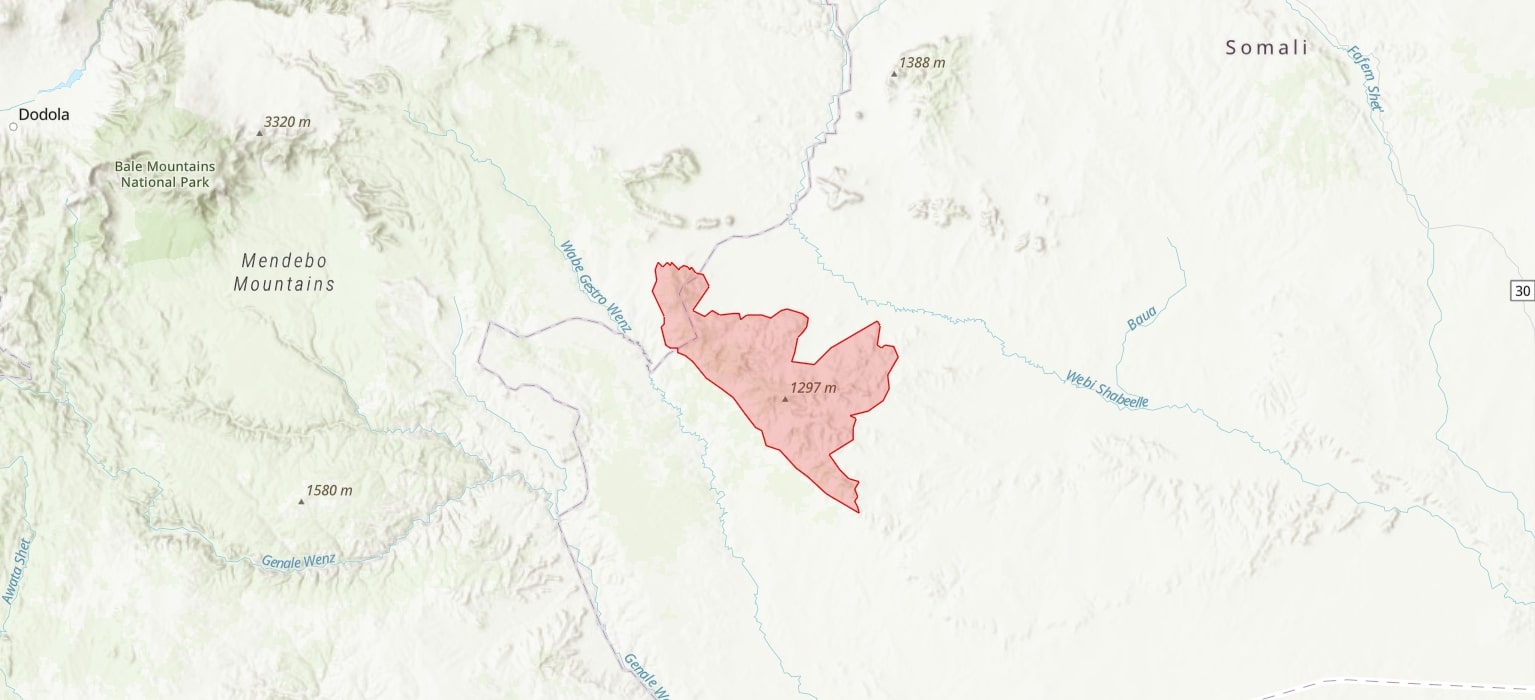
Central co-ordinates: 5.85316 N, 42.10909 E
Area: 3924.57km²
Qualifying IPA Criteria
A(i)Site contains one or more globally threatened species, A(iii)Site contains one or more highly restricted endemic species that are potentially threatened
IPA assessment rationale
The Gerire Hills qualify as an IPA under criterion A(i) as it contains the only known populations of three globally threatened species: Croton elkerensis (VU), Equilabium spananthum (CR) and Gnidia elkerensis (VU), and one of two known populations of Euphorbia omariana (VU). Additionally, this site is triggered under criterion A(iii) as it contains the only known distribution of four highly range restricted endemic plants which may be threatened including: Aloe jacksonii (DD), Anacampseros specksii (DD), Blepharispermum obovatum (not assessed) and Euphorbia bertemariae (DD).
Site description
The Gerire Hills, which reach a height of ca. 1300 m at Mt Ellot, are located between the Weyb and Wabi Shebelle Rivers in the western Ogaden region of southeastern Ethiopia. Administratively, the majority of this IPA belongs to the Somali Regional State, however a small portion of the northernmost boundary of the IPA is contained within the Oromia Regional State. The Gerire Hills are part of a southeastern extension of the Ethiopian highlands called the Audo Mountain Range, which consists of the Bur Uare, Monte Ellot, Bur Caddas and Bur Dami plateaus.
This IPA occurs within the Bale floristic region and is a site of botanical significance due to the presence of several range restricted endemic species.
The IPA boundary is defined by topography and geology that has been inferred from satellite imagery and DEMs (GoogleEarth 2023; Landsat GeoCover 1990) and has been delineated to include plateaus and escarpments (850-1300 m) but not the surrounding plains (<800 m) as all species of interest are associated with these selected landform elements. As this area has not been well studied, these IPA boundaries should be considered as provisional.
Botanical significance
This IPA is a botanically significant site as it contains the entire known populations of eight endemic plant species, namely: Aloe elkerriana, Aloe jacksonii, Anacampseros specksii, Blepharispermum obovatum, Croton elkerensis, Equilabium spananthum, Euphorbia bertemariae and Gnidia elkerensis. Aloe elkeriana and Aloe jacksonii have been described from only this locality, however in recent targeted surveys A. jacksonii was not found (Friis et al., 2019). The Ethiopian endemic succulent, E. omariana, also occurs in this IPA as well as one other location, namely the Sof Omar Caves.
Of these endemics, the following have been assessed: Aloe elkerriana (LC), Aloe jacksonii (DD), Anacampseros specksii (DD), Croton elkerensis (VU), Equilabium spananthum (CR), Euphorbia bertemariea (DD), Euphorbia omariana (EN) and Gnidia elkerensis (VU). Blepharispermum obovatum has not yet been assessed.
The assessment for the endemic species, Aloe elkeriana (LC) is out of date. As it is currently known from only one location and has an estimated area of occurrence of 4km², this species may now be threatened.
This region of Ethiopia is under-collected (Friis et al., 2018), and the gypsum outcrops of southeast Ethiopia in particular have high potential for new species discovery (M. Gilbert, pers. comm., 2023). Seven species at the site concentrated on Burr Caddas plateau are narrow-range endemics currently only known to occur within the IPA boundary, however similar habitat is found over the entire Audo Mountains. Further fieldwork is needed to ascertain whether additional subpopulations of these species occur elsewhere within and outside the Gerire Hills IPA.
Transitional semi evergreen bushland (TSE) is the vegetation community that dominates on the Monte Ellot and the Bur Caddas plateaus. The TSE present within the IPA is a significant outlier from the rest of its mapped distribution and it is highly threatened vegetation type within Ethiopia (van Breugel et al., 2016).
Habitat and geology
The Gerire Hills are characterized by two broad vegetation types: Transitional semi-evergreen bushland (TSE) which is found at ca. 1150 m at higher elevations on the plateau, and Acacia-Commiphora bushand which is found on the lower slopes and adjacent plains (Friis et al., 2018). The presence of TSE is clearly indicated by evergreen species such as by a scattered canopy of Terminalia polycarpa and T. haract, while the Acacia-Commiphora plant community is characterized by deciduous trees and shrubs as well as many species displaying succulent traits (Friis et al. 2018). A detailed vegetation description for the Gerire Hills is provided by Friis et al. (2018). The TSE of the Audo Ranges represents an outlier of this vegetation community as it is ca. 160 km from continuous blocks of this vegetation type, which is primarily distributed along the eastern escarpment of the central Ethiopian highlands (Friis et al., 2018). Some of the vegetation present at the Gerire Hills is secondary, and there is strong evidence that the botanical composition of the vegetation has changed significantly over the last ca. 100 years. Species that were recorded by Mogadisco as being dominant at the site such as Juniperus procera (LC) and Buxus hildebrandtii (not assessed) are no longer so (Friis et al., 2010; Friis et al., 2018).
The geology of the Gerire Hills is unique and highly stratified. The highest points on the Bur Caddas and Monte Ellot plateaus consist of Paleocene sandstones of the Yesomma Formation (Mège et al. 2015). Below the thick sandstone layers are cretaceous limestone layers of the Gorrahei Formation (Mège at al. 2015; Friis at al. 2018; Friis et al 2019). On the northernmost aspects of the mountain range, rocks are significantly tilted exposing underlying gypsum and there are occasional outcrops of gypsum along all edges of the sandstone plateau (D. Mège, pers. comm., 2023). Mège et al. (2015) have demonstrated that erosion by underground rivers and streams and gravity have played a very important role in the creation of the present geomorphology. The tilted rocks and rugged terrain present at the site is caused by the higher rates of erosion of the Gorrahei evaporites which underlay the Yesomma sandstone (Mège at al. 2015). The soil on the sandstone plateau is red and very fine-grained sand, and soils derived from the Gorrahei formation with a high gypsum content are predominately yermosols which are not suitable for agriculture (D. Mège, pers. comm., 2023; Mège et al., 2015). A geomorphological map of the Audo Range can be found in Mège et al. (2015).
This IPA faalls within the kolla Ethiopian climactic zone which is a warm to hot semiarid climate (Mège et al., 2015; Asefa et al., 2020). This zone is between 500-1500 m a.s.l. and has an average annual rainfall between 500-800 mm (Mège et al., 2015). Locally the Audo Mountains experience cooler, wetter conditions than the surrounding plains.
Conservation issues
Despite the high endemicity of plant species in southeastern Ethiopia, this region is under-represented in the protected area network. Currently the Gerire IPA is not formally protected.
Insufficient data on the flora of southeastern Ethiopia in general is inhibiting effective conservation of Ethiopia’s unique and rich plant diversity. The Ogaden has not been better studied to date as a product of a combination of factors; including the remoteness, difficult terrain, limited infrastructure and difficult security conditions, and these issues continue to persist (Mège et al., 2015).
Due to the high amount of gypsum present at the site, this area may be a potential site of future development for gypsum mining. Gypsum is primarily extracted by surface mining, which is inevitably a destructive process for the vegetation cover on the gypsum deposit. While there are not currently known plans to mine the Audo Mountains, mining concessions have been awarded to a company named ‘Best Gypsum Industries’ to explore deposits in the Somali Regional State (Berhane, 2019) and there is currently some gypsum mining activity within the Oromia Regional State (Plaza-Toledo, 2018).
The Audo Mountains are desirable farmland in an otherwise dry area. For this reason, local communities have favoured the Gerire Hills, where they have practiced agriculture on the plateau, the wider valleys and on the less-steep slopes of this area for centuries (Mogadiscio, 1938; translated by Friis et al., 2019). While some species found on the plateau are likely tolerant of some level of disturbance, ongoing and increased grazing will likely impact survival and recruitment of native plant species. In particular, the TSE which occurs on the plateau is under threat of fragmentation, habitat degradation and deforestation for farming and grazing. This pressure is compounded with a shift from traditional farming practices to modern, more intensive agricultural methods (Friis et al., 2018). Intensification of activity in the area is likely, with the development of a new road connecting El Kere to Imi in the north and Melka Chireti in the south facilitating both the expansion of El Kere and the transportation of large agricultural machinery. This could result in a drastic reduction in habitat for the endemic species for which this IPA has been designated (Friis et al., 2018; Friis, 2019).
Competition from invasive species also poses a threat to the persistence of native plants in the area. The invasive, though native, species Dodonaea viscosa subsp. angustifolia has been observed to occur within the IPA (Friis et al., 2018). D. viscosa subsp. angustifolia is an indicator of grazing pressure and former cultivation and outcompetes other native species in these altered environments (Friis et al., 2018).
Inappropriate fire regimes are a threat to the Gerire Hills IPA. Fire is a significant factor shaping the distribution of vegetation in Ethiopia and it acts like a filter for species persistence (van Breugel et al., 2016). Human influence has strongly influenced fire occurrence in Ethiopia (Harris et al., 2023). Human disturbance has altered the fire regime at the site, which has caused a shift in the floristic composition (Friis et al., 2018). In the second half of the 19th century a human-induced fire escaped control on the Monte Ellot and Bur Cadas plateaus and destroyed much of the vegetation there and in the high valleys (Mogadiscio, 1938 translated in Friis et al., 2019). Juniperus procera was previously recorded as a dominant at the site; however, recent survey found only a few individuals of J. procera remaining along the forest border and on rocky areas in higher elevations of the forest at the Gerire Hills (Friis et al., 2018). While J. procera is known to be susceptible to fire, it is likely that this observed decline is also a result of selective logging practices (Friis et al., 2018). TSE and Acacia-Commiphora are vegetation communities which would rarely burn naturally; however, with human disturbance fragmenting and igniting fires, the frequency of fire has increased, and the floristic composition has shifted as a result (van Breugel et al., 2016).
Ecosystem services
The native vegetation present within this IPA provides important resources and ecosystem services to the communities that inhabit the Gerire Hills, from supplying medicine and building materials (Friis et al., 2018; Friis et al., 2019) to regulatory services including the protection of water resources such as the Weyb and the Wabi Shebelle Rivers and the prevention of erosion of the soils present on the plateaus and slopes.
No tourism is known to occur at the site.
Site assessor(s)
Iain Darbyshire, Royal Botanic Gardens, Kew
Sileshi Nemomissa, Addis Ababa University
Sebsebe Demissew, Addis Ababa University
Ermias Lulekal, Addis Ababa University
Gabriella Hoban, Royal Botanic Gardens, Kew
IPA criterion A species
| Species | Qualifying sub-criterion | ≥ 1% of global population | ≥ 5% of national population | 1 of 5 best sites nationally | Entire global population | Socio-economically important | Abundance at site |
|---|---|---|---|---|---|---|---|
| Croton elkerensis Friis & M.G.Gilbert | A(i) |  |
|
|
|
 |
|
| Gnidia elkerensis Friis & Sebsebe | A(i) | |
|
|
|
|
|
| Euphorbia bertemariae Bisseret & Dioli | A(iii) | |
|
|
|
|
|
| Euphorbia omariana M.G.Gilbert | A(i) | |
|
|
|
|
|
| Equilabium spananthum (A.J.Paton, Friis & Sebsebe) A.J.Paton | A(i) | |
|
|
|
|
|
| Aloe jacksonii Reynolds | A(iii) | |
|
|
|
|
|
| Anacampseros specksii Dreher | A(iii) | |
|
|
|
|
|
| Blepharispermum obovatum Chiov. | A(iii) | |
|
|
|
|
Croton elkerensis Friis & M.G.Gilbert
Qualifying sub-criterion:
A(i)
≥ 1% of global population:
≥ 5% of national population:
1 of 5 best sites nationally:
Entire global population:
Socio-economically important:
Abundance at site:
Gnidia elkerensis Friis & Sebsebe
Qualifying sub-criterion:
A(i)
≥ 1% of global population:
≥ 5% of national population:
1 of 5 best sites nationally:
Entire global population:
Socio-economically important:
Abundance at site:
Euphorbia bertemariae Bisseret & Dioli
Qualifying sub-criterion:
A(iii)
≥ 1% of global population:
≥ 5% of national population:
1 of 5 best sites nationally:
Entire global population:
Socio-economically important:
Abundance at site:
Euphorbia omariana M.G.Gilbert
Qualifying sub-criterion:
A(i)
≥ 1% of global population:
≥ 5% of national population:
1 of 5 best sites nationally:
Entire global population:
Socio-economically important:
Abundance at site:
Equilabium spananthum (A.J.Paton, Friis & Sebsebe) A.J.Paton
Qualifying sub-criterion:
A(i)
≥ 1% of global population:
≥ 5% of national population:
1 of 5 best sites nationally:
Entire global population:
Socio-economically important:
Abundance at site:
Aloe jacksonii Reynolds
Qualifying sub-criterion:
A(iii)
≥ 1% of global population:
≥ 5% of national population:
1 of 5 best sites nationally:
Entire global population:
Socio-economically important:
Abundance at site:
Anacampseros specksii Dreher
Qualifying sub-criterion:
A(iii)
≥ 1% of global population:
≥ 5% of national population:
1 of 5 best sites nationally:
Entire global population:
Socio-economically important:
Abundance at site:
Blepharispermum obovatum Chiov.
Qualifying sub-criterion:
A(iii)
≥ 1% of global population:
≥ 5% of national population:
1 of 5 best sites nationally:
Entire global population:
Socio-economically important:
Abundance at site:
General site habitats
| General site habitat | Percent coverage | Importance |
|---|---|---|
| Shrubland - Subtropical/Tropical Dry Shrubland | |
Unknown |
| Unknown | |
Unknown |
Shrubland - Subtropical/Tropical Dry Shrubland
Percent coverage:
Importance:
Unknown
Unknown
Percent coverage:
Importance:
Unknown
Land use types
| Land use type | Percent coverage | Importance |
|---|---|---|
| Agriculture (arable) | |
Major |
| Agriculture (pastoral) | |
Major |
| Harvesting of wild resources | |
Unknown |
Agriculture (arable)
Percent coverage:
Importance:
Major
Agriculture (pastoral)
Percent coverage:
Importance:
Major
Harvesting of wild resources
Percent coverage:
Importance:
Unknown
Threats
| Threat | Severity | Timing |
|---|---|---|
| Agriculture & aquaculture - Annual & perennial non-timber crops - Small-holder farming | High | Ongoing - increasing |
| Natural system modifications - Fire & fire suppression | High | Ongoing - trend unknown |
| Residential & commercial development | Medium | Ongoing - trend unknown |
| Agriculture & aquaculture - Livestock farming & ranching - Small-holder grazing, ranching or farming | Medium | Ongoing - trend unknown |
| Invasive & other problematic species, genes & diseases | Medium | Ongoing - trend unknown |
Agriculture & aquaculture - Annual & perennial non-timber crops - Small-holder farming
Severity:
High
Timing:
Ongoing - increasing
Natural system modifications - Fire & fire suppression
Severity:
High
Timing:
Ongoing - trend unknown
Residential & commercial development
Severity:
Medium
Timing:
Ongoing - trend unknown
Agriculture & aquaculture - Livestock farming & ranching - Small-holder grazing, ranching or farming
Severity:
Medium
Timing:
Ongoing - trend unknown
Invasive & other problematic species, genes & diseases
Severity:
Medium
Timing:
Ongoing - trend unknown
Management type
| Management type | Description | Year started | Year finished |
|---|---|---|---|
| No management plan in place | |
|
No management plan in place
Year started:
Year finished:
Bibliography
Atlas of the Potential Vegetation of Ethiopia.
Ethiopian vegetation types, climate and topography
Plant Diversity, Vol 42, page(s) 302-311
‘The Landscape and Landforms of the Ogaden, Southeast Ethiopia.’ In Billi, P. Landscapes and Landforms of Ethiopia
Google Earth Pro 2023
Towards Socially Responsible Mining Investment in Ethiopia: Imagining a New Moral Economy
Current and Future Fire Regimes and Their Influence on Natural Vegetation in Ethiopia
Ecosystems, Vol 19, page(s) 369–386
Diversity and endemism of the flora of Ethiopia and Eritrea: state of knowledge and future perspectives
Rend. Fis. Acc. Lincei, Vol 32, page(s) 675–697
The transitional semi-evergreen bushland in Ethiopia: characterization and mapping of its distribution using predictive modelling
Applied Vegetation Science, Vol 19, page(s) 335-367
Cenni monografici sul paese dei Gherire (Mogadiscio, 1938) – a pioneer work on the Gerire Hills in western Ogaden, south-eastern Ethiopia : – introduced, translated and provided with annotations and a revision of the botanical collections
Webbia, Vol 74 (supplement), page(s) 1-108
The Gerire Hills, SE Ethiopia: ecology and phytogeographical position of an additional local endemic, Anacampseros specksii (Anacampserotaceae)
Webbia, Vol 74, page(s) 185-192
Forests, and forest trees of northeast tropical Africa. Their natural habitats and distribution patterns in Ethiopia, Djibouti and Somalia
Journal of Tropical Ecology, Vol 9 (pub. Royal Botanic Gardens, Kew), page(s) 43-44
The Mineral Industry of Ethiopia in 2017-2018
The concessionaires will invest 4.3 billion Br to explore and extract minerals
Humans and climate modulate fire activity across Ethiopia
Fire Ecology, Vol 19
Landsat GeoCover 2000
The Gerire Hills, a SE Ethiopian outpost of the transitional semi-evergreen bushland: vegetation, endemism and three new species, Croton elkerensis (Euphorbiaceae), Gnidia elkerensis (Thymelaeaceae), and Plectranthus spananthus (Lamiaceae)
Webbia, Vol 73:2, page(s) 203-223


Recommended citation
Iain Darbyshire, Sileshi Nemomissa, Sebsebe Demissew, Ermias Lulekal, Gabriella Hoban (2024) Tropical Important Plant Areas Explorer: Gerire Hills (Ethiopia). https://tipas.kew.org/site/gerire-hills/ (Accessed on 27/07/2024)