
Country: New Guinea
Administrative region: Papua (Province)
Central co-ordinates: 2.28318 S, 133.95267 E
Area: 1248km²
Qualifying IPA Criteria
C(i)Site contains globally threatened or restricted habitat or vegetation types
IPA assessment rationale
Mangrove forests within Bintuni bay, West Papua comprise 8.4% of Indonesia’s total mangrove resource, and 1.9% of the world’s mangrove cover, so they are a globally significant area of this habitat type as well a huge store of 'blue' carbon. Bintuni Bay has one of the five largest and most intact mangrove sites in Indonesia, along with South Papua, the Aru islands, North Kalimantan and Riau (Arifianti et al. 2025).
Site description
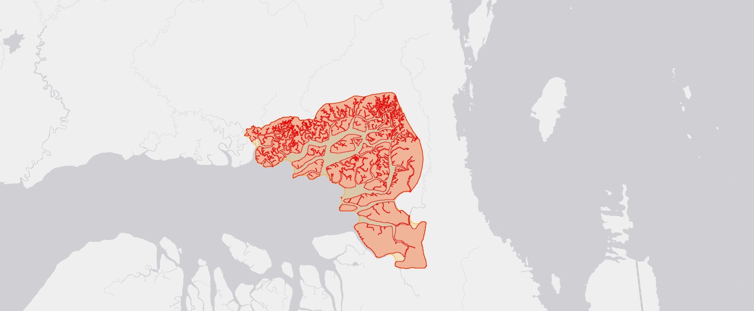
The mangrove ecosystems within Bintuni Bay are of global significance, and those within the Teluk Bintuni Nature Reserve are an intact primary example of this habitat type. The Nature Reserve covers 1248 square km and is located on the eastern side of Bintuni Bay in north-west New Guinea. It is bordered on the northern side by the town of Bintuni, and to the south and east by logging concessions (Global Forest Watch 2025). The ecosystem is semi-terrestrial and the protected area includes islands, peninsulas and estuaries.
Botanical significance
West Papua has about 8-10% of the total world's mangrove area (Sasmito et al. 2020), with 1.9% of the world’s mangrove cover is within Bintuni Bay (Sillanpaa et al. 2017). Mangroves are important for carbon storage ('blue carbon') because, although the quantity of carbon stored varies considerably across the different parts of the mangrove system (Sasmito et al. 2020), they store more carbon than terrestrial forests (Arifanti et al. 2022). Mangroves act as mitigation against coastal erosion, storms and natural disasters as well as being a distinct vegetation type with a unique assemblage of species. The timber of Rhizophora species is valued for bridges and buildings due to its resistance to rot and termites (Samal et al., 2023).
Habitat and geology
The mangroves in Bintuni Bay are dominated by Rhizophora apiculata and R. mucronata, along with other common species Bruguiera gymnorrhiza, Bruguiera parviflora and Ceriops tagal (Wahyudi et al. 2013). A total of thirty species of mangrove trees are documented in this ecosystem (Yudha et al. 2024).
Conservation issues
The primary causes of the loss and degradation of mangroves in Papua include timber extraction, conversion from mangrove forests into aquaculture ponds, and infrastructure development, such as for settlements and the oil industry. The Teluk Bintuni Nature Reserve is legally protected, but to the north of the area where it adjoins the town of Bintuni, forest loss is visible at the edges of the protected area (Global Forest Watch 2025), most likely due to agricultural conversion and demand for timber. Mangroves are also threatened due to climate change, due to sea level rise beyond their adapted capacity and increased severity of tropical cyclones (Hülsen et al. 2025)
Ecosystem services
Mangroves buffer the impact of large storms and tsunamis on the coastline. They are important habitat for numerous marine animal species (such as fishes and crustaceans) as well as stopover and foraging habitat migratory shorebirds (Yudha et al. 2024).
Site assessor(s)
Assessed by:
Laura Jennings, Royal Botanic Garden Kew
Liam Trethowan, Royal Botanic Gardens, Kew
Charlie Heatubun, The Provincial Government of West Papua and Universitas Papua
Jimmy Wanma, State University of Papua
Date of first assessment: 21st Dec 2025
IPA criterion C qualifying habitats
| Habitat | Qualifying sub-criterion | ≥ 5% of national resource | ≥ 10% of national resource | 1 of 5 best sites nationally | Areal coverage at site |
|---|---|---|---|---|---|
| Mangrove | C(i) |  |
 |
|
Mangrove
Qualifying sub-criterion:
C(i)
≥ 5% of national resource:
≥ 10% of national resource:
Areal coverage at site:
General site habitats
| General site habitat | Percent coverage | Importance |
|---|---|---|
| Forest - Subtropical/Tropical Mangrove Forest Vegetation Above High Tide Level | |
Major |
Forest - Subtropical/Tropical Mangrove Forest Vegetation Above High Tide Level
Percent coverage:
Importance:
Major
Land use types
| Land use type | Percent coverage | Importance |
|---|---|---|
| Nature conservation | |
Nature conservation
Percent coverage:
Importance:
Threats
| Threat | Severity | Timing |
|---|---|---|
| Climate change & severe weather - Storms & flooding | Unknown | Ongoing - increasing |
Climate change & severe weather - Storms & flooding
Severity:
Unknown
Timing:
Ongoing - increasing
Protected areas
| Protected area name | Protected area type | Relationship with IPA | Areal overlap |
|---|---|---|---|
| Bintuni Bay Nature Reserve | National Nature Reserve | protected/conservation area matches IPA | |
Bintuni Bay Nature Reserve
Protected area type:
National Nature Reserve
Relationship with IPA:
protected/conservation area matches IPA
Areal overlap:
Bibliography
Mangroves and their services are at risk from tropical cyclones and sea level rise under climate change.
Communications Earth & Environment, Vol 6(1), page(s) 262
Global Forest Watch
Vegetation regeneration in a sustainably harvested mangrove forest in West Papua, Indonesia
Forest Ecology and Management, Vol 390, page(s) 137-146
Challenges and strategies for sustainable mangrove management in Indonesia: a review
Forests, Vol 13, page(s) 695
Mangrove blue carbon stocks and dynamics are controlled by hydrogeomorphic settings and land use change
Global Change Biology, Vol 26(5), page(s) 3028-3039
Seed trees method system of silviculture for harvesting and managing mangrove forest in Indonesia, study case learned from Bintuni Bay, West Papua after being in practices for 24 years
International Journal of Sustainable Future for Human Security, Vol 100, page(s) 1-7
The True Mangroves of Bintuni Bay, Indonesia with Special Notes on the Existence of Amyema mackayensis (Blakely) Danser and Brownlowia argentata Kurz.
Jurnal Ilmu Kehutanan, Vol 18(2), page(s) 134-141


Recommended citation
Laura Jennings, Liam Trethowan, Charlie Heatubun, Jimmy Wanma (2026) Tropical Important Plant Areas Explorer: Bintuni mangroves (New Guinea). https://tipas.kew.org/site/bintuni-mangroves/ (Accessed on 25/08/2026)