Country: Mozambique
Administrative region: Inhambane (Province)
Central co-ordinates: 21.73061 S, 35.44182 E
Area: 190km²
Qualifying IPA Criteria
A(i)Site contains one or more globally threatened species
IPA assessment rationale
The Bazaruto Archipelago qualifies as an IPA under Criterion A(i), as these islands support populations of two, and potentially three endemic and globally threatened species. Bazaruto Island is considered likely to be the main global stronghold for the Vulnerable Jatropha subaequiloba and Magaruque Island is the only known locality globally for the Critically Endangered Memecylon insulare. Everett et al. (2008) documented the presence of the globally Endangered Ochna beirensis in scrub thickets in secondary dunes in this IPA, but this record requires confirmation. In addition, the seagrass communities surrounding the islands support a population of the globally Vulnerable Zostera capensis, which extends around the coast of southern Africa; the Bazaruto population is of national importance.
In General, this IPA supports populations of 18 species that are endemic or near-endemic to Mozambique, according to Darbyshire et al. (2019), although only seven of these qualify under sub-criterion B(ii) and so this site does not currently meet the threshold under that sub-criterion. However, further botanical surveys are required as it is considered likely that there may be further rare and threatened plant species present in under-explored habitats at this IPA.
Site description
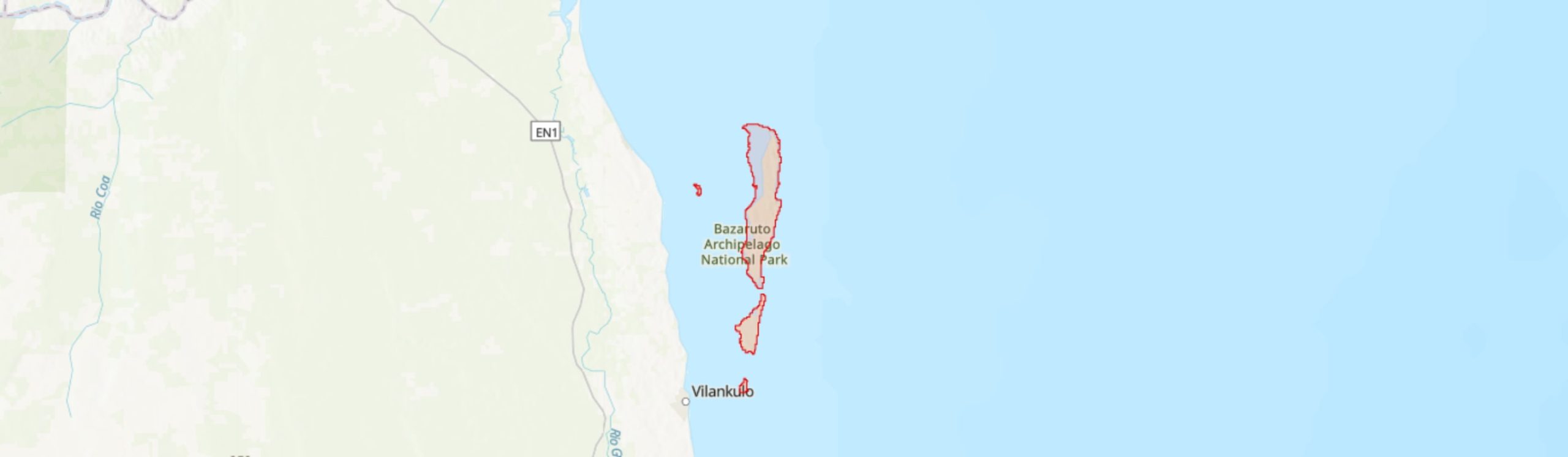
The Bazaruto Archipelago is located between the latitudes 21°30' – 22°10' S and longitudes 35°22' – 35°30' E, off the Indian Ocean coast of northern Inhambane province, between Vilanculos and Inhassoro districts in southern Mozambique. It consists of five Islands, Bazaruto (120.5 km2), Benguérua (32.86 km2), Magaruque (2.96 km2), Santa Carolina (2.10 km2), and Bangué (0.66 km2) (Everett et al. 2008; Díaz-Pelegrín et al. 2016). This Archipelago forms an Important Plant Areas (IPA) located within the marine protected area of the Bazaruto Archipelago National Park (BANP), which spans 1,430 km2 (African Parks 2021).
These islands contain a range of terrestrial and marine habitats and provide refuge for a great variety of plant and animal species (Everett et al. 2008), including a group of endemic and near-endemic species to Mozambique. Only four of the islands, Bazaruto, Benguérua, Magaruque, and Santa Carolina are included in the IPA, as according to Everett et al. (2008) Bangué Island comprises only beach and pioneer dune vegetation, and so is unlikely to be of high botanical importance.
Botanical significance
This site is of high botanical importance as it holds a number of range-restricted species of high conservation concern, of which three are globally threatened and endemic species to Mozambique: Memecylon insulare (CR; restricted to Magaruque Island), Jatropha subaequiloba (VU; found on Bazaruto Island and nearby São Sebastião Peninsula), and Ochna beirensis (EN; possibly found on these islands and also nearby Beira and Cheringoma). Ochna beirensis has been documented as present in BANP by Everett et al. (2008), but this record requires confirmation as no herbarium specimen has been seen from this site by the current authors. Although in BANP the botanical component is currently under-explored, the islands are known so far to support eight national endemic plant taxa (plants that only occur in Mozambique) and 10 near-endemic plant taxa (plants that are restricted to Mozambique and neighbouring countries). The endemic consist of the three previous mentioned globally threatened species, plus four Least Concern species, Chamaecrista paralias, Psydrax moggii, Triainolepis sancta and Zanthoxylum delagoense P.G.Waterman, and one that has not yet been assessed but is considered likely to be of Least Concern, Spermacoce kirkii. To date, only the three islands Bazaruto, Magaruque, and Santa Carolina are known to hold range-restricted plant species of high conservation importance, but given that Benguerua Island holds a similar vegetation composition to Bazaruto Island, future surveys are likely to reveal that Benguerua also holds populations of some of these priority species.
The seagrass communities around the islands are also of importance and contain a population of the globally Vulnerable Zostera capensis.
Habitat and geology
This IPA results from a dynamic process of stacking dunes, originating from coastal deposits from the Indian Ocean. Three dune forms can be recognised, namely ancient dunes, an ocean dune cord, and recent coastal formations (Díaz Pelegrín et al. 2016). The soils are sandy, rocky, and white and are poor for intensive agricultural activity due to the limiting factors of low water retention capacity and low fertility (Díaz Pelegrín et al. 2016). The climate is classified as Humid Tropical Coastal, which is biseasonal, with the peak dry season in June to August and the peak humid season in December to March. The islands have an annual rainfall of approximately 1,200 mm, and an annual temperature average ranging from 20° – 26°C according to the season. The geographical elevation ranges from 0 – 4 m at the sea line and inland wetlands up to 90 m on the highest dunes near the coast. The combination of these different physical elements has significant effects on the biotic composition and diversity of this IPA.
This IPA has been mapped and briefly classified into 11 natural terrestrial vegetation communities (Dutton & Drummond 2008): (1) savanna grassland, maintained principally by a perched water table and dominated by Garcinia livingstonei and Ozoroa obovata; (2) marsh or edaphic grassland, with a range of dominant grasses including Sporobolus virginicus, Diplachne fusca and Andropogon eucomus; (3) evergreen dune forest, which is highly degraded and only known from three small remnant patches on Benguérua and Magaruque, with occurrence of Balanites maughamii and Ozoroa obovata; (4) secondary dune forest, dominated by Mimusops caffra, Olax dissitiflora and Bourreria petiolaris; (5) scrub thicket, dominated by Eugenia spp. and Euclea racemosa; (6) swamp forest, severely damaged by agriculture; (7) woodland dominated by Dialium schlechteri and Julbernardia globiflora; (8) thicket associated with the perched water table at the base of west facing coastal sand dunes, dominated by Olax dissitiflora, Bourreria petiolaris and Acacia karroo; (9) pioneer dune flora, dominated by species such as Ipomoea pes-caprae, Scaevola plumieri and Cyperus crassipes; (10) mangroves, only known from Bazaruto, Benguérua and Santa Carolina, dominated by Rhizophora mucronata, Bruguiera cylindrica and Ceriops tagal; and (11) salt marshes or salinas, also known only from Bazaruto, Benguérua and Santa Carolina, dominated by, Sesuvium portulacastrum, Salicornia perennis and Salicornia perrieri.
Bazaruto Island supports the largest areas of natural habitat, where nine of the 11 vegetation types occur, with only evergreen dune forest and Dialium-Julbernardia woodland absent. Four vegetation types can be found across Magaruque Island, namely evergreen dune forest, secondary dune forest, scrub thicket, and pioneer dune vegetation. The Santa Carolina Island holds a large mangrove community, secondary dune forest,and salt marsh (Dutton & Drummond 2008), whilst evergreen dune forest, and Dialium Julbernardia woodland occur on Benguerua Island (Downs & Wirminghaus 1997; Dutton & Drummond 2008). From these 11 terrestrial vegetation assemblages in the BANP, three are of highest botanical significance, as they hold species of conservation importance: Memecylon insulare occurs in evergreen dune forest, whilst Jatropha subaequiloba is found in secondary dune forest and edaphic grassland. The secondary dune forests are also suitable for Ochna beirensis.
There is also a significant extent of seagrass communities within the IPA, associated with the sandy tidal flats and dominated by Thalassodendron ciliatum, Cymodocea rotundata, Halodule uninervis and Zostera capensis (Bandeira et al. 2008).
Conservation issues
The Bazaruto Archipelago National Park (BANP) was primarily designated to protect marine mammals (dugongs, dolphins, whales), sharks, sea turtles, corals, Echinoderms (Holoturias), molluscs, and fish species (Vaz et al. 2008). However, both marine and terrestrial ecosystems are now benefitting from conservation measures undertaken by African Parks (African Parks 2021).
Since 2017, the BANP has been managed by African Parks in partnership with the Mozambique government under a 25-year agreement. African Parks’ stated priorities are to strengthen law enforcement in order to reduce threats to the biodiversity of the BANP and to build support for the conservation actions through community engagement, training, and local employment. 34 new rangers have been employed and trained as part of this process (African Parks 2021).
With regard to terrestrial biodiversity, birds are the most studied fauna group to date, which also benefit from international protection status since many are migratory (Díaz Pelegrín et al. 2016). Most of the key terrestrial habitats in the BANP, including mangroves forests and some lagoons and swamps, have been given the designation of Total Terrestrial Protection Zones (TTPZ) (Díaz Pelegrín et al. 2016). However, some of these areas are currently under pressure owing to unsustainable tourism and human population growth. Therefore, the integrity of the terrestrial biodiversity of this IPA is threatened by settlement expansion and tourism infrastructure and footfall, unsustainable subsistence and consumption activities such as intensive firewood harvesting, agriculture, some livestock grazing (goats), and collection of medicinal plants (Dutton 1990; Downs & Wirminghaus 1997; Everett et al. 2008, Díaz Pelegrín et al. 2016). There are also many cases of uncontrolled fire events reported in the forests, sometimes being set intentionally for small-scale shifting cultivation and pasture areas (Díaz Pelegrín et al. 2016). These issues must be addressed if the botanical importance of these islands is to be maintained.
The seagrass communities are also protected, designated as Marine Total Protection Zones (MTPZ).
Ecosystem services
Apart from BANP's role in regulating and maintaining marine ecological processes and providing natural resources to local communities, terrestrial ecosystems also provide important ecosystem services. They help to maintain the natural integrity of the islands by protecting against coastal erosion from the ocean and winds. Terrestrial and coastal forests also contribute significantly to carbon storage and climate regulation, particularly related to the precipitation cycle. Seagrass carpets are also important for carbon storage (Fourqurean et al. 2012). The mangrove forests, besides storing carbon, constitute an important micro-ecosystem and ecological role (being the reproductive grounds and a refuge for marine fauna) and have socio-economic value. The local human populations also take advantage of the terrestrial habitats, where they harvest firewood and practice subsistence agriculture, and harvesting wild fruits and medicinal plants (Díaz Pelegrín et al. 2016). The touristic potential of the Bazaruto Archipelago is also high due to the beauty of the natural resources, beaches, coral reefs, seagrass carpets, and crystal clear waters for diving and marine megafauna; because of these factors, the Islands are regarded as a key area for nature-based tourism in Mozambique (World Bank 2018).
Site assessor(s)
Clayton Langa, Agricultural Research Institute of Mozambique (IIAM)
Castigo Datizua, Agricultural Research Institute of Mozambique (IIAM)
Iain Darbyshire, Royal Botanic Gardens, Kew
Sophie Richards, Royal Botanic Gardens, Kew
IPA criterion A species
| Species | Qualifying sub-criterion | ≥ 1% of global population | ≥ 5% of national population | 1 of 5 best sites nationally | Entire global population | Socio-economically important | Abundance at site |
|---|---|---|---|---|---|---|---|
| Memecylon insulare A.Fern. & R.Fern. | A(i) |  |
|
|
|
 |
Unknown |
| Jatropha subaequiloba Radcl.-Sm. | A(i) | |
|
|
|
|
Unknown |
| Ochna beirensis N.Robson | A(i) | |
|
|
|
|
Unknown |
| Zostera capensis Setch. | A(i) | |
|
|
|
|
Common |
Memecylon insulare A.Fern. & R.Fern.
Qualifying sub-criterion:
A(i)
≥ 1% of global population:
≥ 5% of national population:
1 of 5 best sites nationally:
Entire global population:
Socio-economically important:
Abundance at site:
Unknown
Jatropha subaequiloba Radcl.-Sm.
Qualifying sub-criterion:
A(i)
≥ 1% of global population:
≥ 5% of national population:
1 of 5 best sites nationally:
Entire global population:
Socio-economically important:
Abundance at site:
Unknown
Ochna beirensis N.Robson
Qualifying sub-criterion:
A(i)
≥ 1% of global population:
≥ 5% of national population:
1 of 5 best sites nationally:
Entire global population:
Socio-economically important:
Abundance at site:
Unknown
Zostera capensis Setch.
Qualifying sub-criterion:
A(i)
≥ 1% of global population:
≥ 5% of national population:
1 of 5 best sites nationally:
Entire global population:
Socio-economically important:
Abundance at site:
Common
General site habitats
| General site habitat | Percent coverage | Importance |
|---|---|---|
| Forest - Subtropical/Tropical Mangrove Forest Vegetation Above High Tide Level | |
Major |
| Forest - Subtropical/Tropical Dry Forest | |
Minor |
| Forest - Subtropical/Tropical Swamp Forest | |
Minor |
| Shrubland - Subtropical/Tropical Dry Shrubland | |
Major |
| Grassland - Subtropical/Tropical Seasonally Wet/Flooded Lowland Grassland | |
Major |
| Wetlands (inland) - Permanent Freshwater Marshes/Pools [under 8 ha] | |
Minor |
| Marine Intertidal - Salt Marshes (Emergent Grasses) | |
Major |
| Marine Neritic (Submergent Nearshore Continental Shelf or Oceanic Island) - Seagrass (Submerged) | |
Major |
| Marine Coastal/Supratidal - Coastal Sand Dunes | |
Major |
Forest - Subtropical/Tropical Mangrove Forest Vegetation Above High Tide Level
Percent coverage:
Importance:
Major
Forest - Subtropical/Tropical Dry Forest
Percent coverage:
Importance:
Minor
Forest - Subtropical/Tropical Swamp Forest
Percent coverage:
Importance:
Minor
Shrubland - Subtropical/Tropical Dry Shrubland
Percent coverage:
Importance:
Major
Grassland - Subtropical/Tropical Seasonally Wet/Flooded Lowland Grassland
Percent coverage:
Importance:
Major
Wetlands (inland) - Permanent Freshwater Marshes/Pools [under 8 ha]
Percent coverage:
Importance:
Minor
Marine Intertidal - Salt Marshes (Emergent Grasses)
Percent coverage:
Importance:
Major
Marine Neritic (Submergent Nearshore Continental Shelf or Oceanic Island) - Seagrass (Submerged)
Percent coverage:
Importance:
Major
Marine Coastal/Supratidal - Coastal Sand Dunes
Percent coverage:
Importance:
Major
Land use types
| Land use type | Percent coverage | Importance |
|---|---|---|
| Nature conservation | |
Major |
| Agriculture (pastoral) | |
Minor |
| Agriculture (arable) | |
Unknown |
| Tourism / Recreation | |
Major |
| Residential / urban development | |
Major |
| Harvesting of wild resources | |
Unknown |
Nature conservation
Percent coverage:
Importance:
Major
Agriculture (pastoral)
Percent coverage:
Importance:
Minor
Agriculture (arable)
Percent coverage:
Importance:
Unknown
Tourism / Recreation
Percent coverage:
Importance:
Major
Residential / urban development
Percent coverage:
Importance:
Major
Harvesting of wild resources
Percent coverage:
Importance:
Unknown
Threats
| Threat | Severity | Timing |
|---|---|---|
| Residential & commercial development - Housing & urban areas | Medium | Ongoing - increasing |
| Residential & commercial development - Tourism & recreation areas | High | Ongoing - increasing |
| Agriculture & aquaculture - Annual & perennial non-timber crops - Shifting agriculture | Unknown | Ongoing - trend unknown |
| Agriculture & aquaculture - Livestock farming & ranching - Small-holder grazing, ranching or farming | Low | Ongoing - trend unknown |
| Transportation & service corridors - Roads & railroads | Medium | Ongoing - trend unknown |
| Biological resource use - Gathering terrestrial plants - Motivation Unknown/Unrecorded | Low | Ongoing - trend unknown |
| Biological resource use - Logging & wood harvesting - Motivation Unknown/Unrecorded | Low | Ongoing - trend unknown |
| Human intrusions & disturbance - Recreational activities | High | Ongoing - increasing |
| Natural system modifications - Fire & fire suppression - Increase in fire frequency/intensity | Unknown | Ongoing - trend unknown |
Residential & commercial development - Housing & urban areas
Severity:
Medium
Timing:
Ongoing - increasing
Residential & commercial development - Tourism & recreation areas
Severity:
High
Timing:
Ongoing - increasing
Agriculture & aquaculture - Annual & perennial non-timber crops - Shifting agriculture
Severity:
Unknown
Timing:
Ongoing - trend unknown
Agriculture & aquaculture - Livestock farming & ranching - Small-holder grazing, ranching or farming
Severity:
Low
Timing:
Ongoing - trend unknown
Transportation & service corridors - Roads & railroads
Severity:
Medium
Timing:
Ongoing - trend unknown
Biological resource use - Gathering terrestrial plants - Motivation Unknown/Unrecorded
Severity:
Low
Timing:
Ongoing - trend unknown
Biological resource use - Logging & wood harvesting - Motivation Unknown/Unrecorded
Severity:
Low
Timing:
Ongoing - trend unknown
Human intrusions & disturbance - Recreational activities
Severity:
High
Timing:
Ongoing - increasing
Natural system modifications - Fire & fire suppression - Increase in fire frequency/intensity
Severity:
Unknown
Timing:
Ongoing - trend unknown
Protected areas
| Protected area name | Protected area type | Relationship with IPA | Areal overlap |
|---|---|---|---|
| Bazaruto Archipelago National Park | National Park | protected/conservation area encompasses IPA | 190 |
Bazaruto Archipelago National Park
Protected area type:
National Park
Relationship with IPA:
protected/conservation area encompasses IPA
Areal overlap:
190
Conservation designation
| Designation name | Protected area | Relationship with IPA | Areal overlap |
|---|---|---|---|
| Grande Bazaruto | Key Biodiversity Area | protected/conservation area encompasses IPA | 190 |
| Greater Bazaruto | Important Bird Area | protected/conservation area encompasses IPA | 190 |
Grande Bazaruto
Protected area:
Key Biodiversity Area
Relationship with IPA:
protected/conservation area encompasses IPA
Areal overlap:
190
Greater Bazaruto
Protected area:
Important Bird Area
Relationship with IPA:
protected/conservation area encompasses IPA
Areal overlap:
190
Management type
| Management type | Description | Year started | Year finished |
|---|---|---|---|
| Protected Area management plan in place | The Bazaruto Archipelago National Park (BANP) is now under management by African Parks in partnership with the Mozambique government through the National Administration of Conservation Areas (ANAC), which directs the management of Mozambique's national parks and reserves. The signed memorandum between these institutions since 2017 is for 25 years, with the main objective to ensure the restoration, development, and management of the Park. African Parks’ stated priorities are to strengthen law enforcement in order to reduce threats to the biodiversity of the BANP and to build support for the conservation actions through community engagement, training, and local employment. 34 new rangers have been employed and trained as part of this process (African Parks 2021). | 2017 | 2041 |
Protected Area management plan in place
The Bazaruto Archipelago National Park (BANP) is now under management by African Parks in partnership with the Mozambique government through the National Administration of Conservation Areas (ANAC), which directs the management of Mozambique's national parks and reserves. The signed memorandum between these institutions since 2017 is for 25 years, with the main objective to ensure the restoration, development, and management of the Park. African Parks’ stated priorities are to strengthen law enforcement in order to reduce threats to the biodiversity of the BANP and to build support for the conservation actions through community engagement, training, and local employment. 34 new rangers have been employed and trained as part of this process (African Parks 2021).
Year started:
2017
Year finished:
2041
Bibliography
Bazaruto
Seagrass beds. In: Everett, B.I., van der Elst, R.P. & Schleyer, M.H. (eds.), A Natural History of the Bazaruto Archipelago, Mozambique.
The endemic plants of Mozambique: diversity and conservation status
PhytoKeys, Vol 136, page(s) 45 - 96
Parque Nacional do Arquipélago de Bazaruto (PNAB). Plano de Maneio 2016 – 2025 de uma Área de Conservação Marinha, Província de Inhambane, Moçambique (2 volumes).
The terrestrial vertebrates of the Bazaruto Archipelago, Mozambique: a biogeographical perspective.
Journal of Biogeography, Vol 24, page(s) 591- 602
Report to the Honourable Minister of Agriculture on a conservation master plan for sustainable development of the Bazaruto Archipelago. People’s Republic of Mozambique
A Natural History of the Bazaruto Archipelago, Mozambique
Seagrass ecosystems as a globally significant carbon stock
Nature Geoscience Available online
Mozambique Country Forest Note. Report No: AUS0000336
Plano de Maneio do Parque Nacional do Arquipélago do Bazaruto 2008-2012
Terrestrial habitats and vegetation. In: Everett, B.I., van der Elst, R.P. & Schleyer, M.H. (eds.), A Natural History of the Bazaruto Archipelago, Mozambique.


Recommended citation
Clayton Langa, Castigo Datizua, Iain Darbyshire, Sophie Richards (2024) Tropical Important Plant Areas Explorer: Bazaruto Archipelago (Mozambique). https://tipas.kew.org/site/bazaruto-archipelago/ (Accessed on 27/07/2024)