
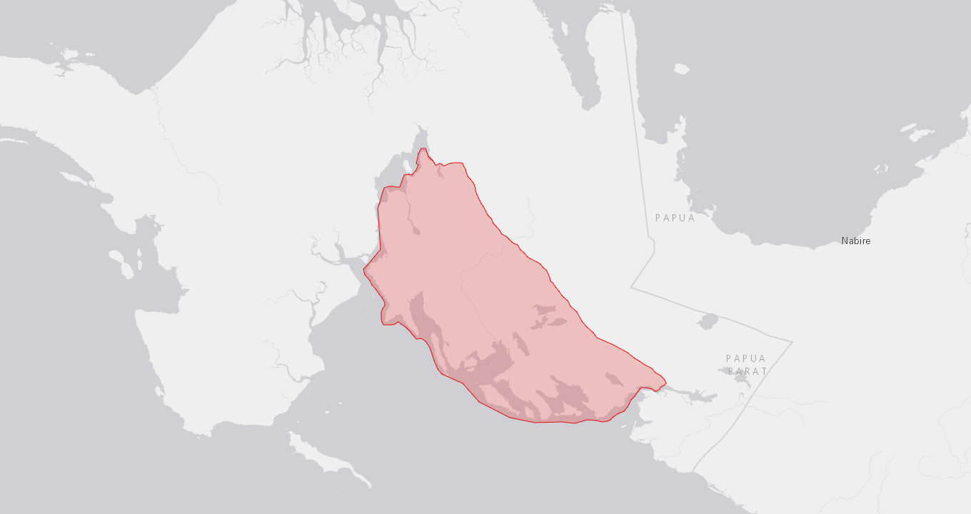
Country: New Guinea
Administrative region: Papua (Province)
Central co-ordinates: 3.62588 S, 134.02782 E
Area: 7161km²
Qualifying IPA Criteria
A(i)Site contains one or more globally threatened species
IPA assessment rationale
A relatively intact coastal and karst ecosystem with a unique blend of vegetation types, showing transitions from saline to fresh water and from lowland to mid-montane habitats on limestone over short distances. The flora is poorly known but there are some endemic and/or endangered orchid species. The marine habitats are among the richest in the world, and protecting the habitats on land will also help to protect the marine environment.
Site description
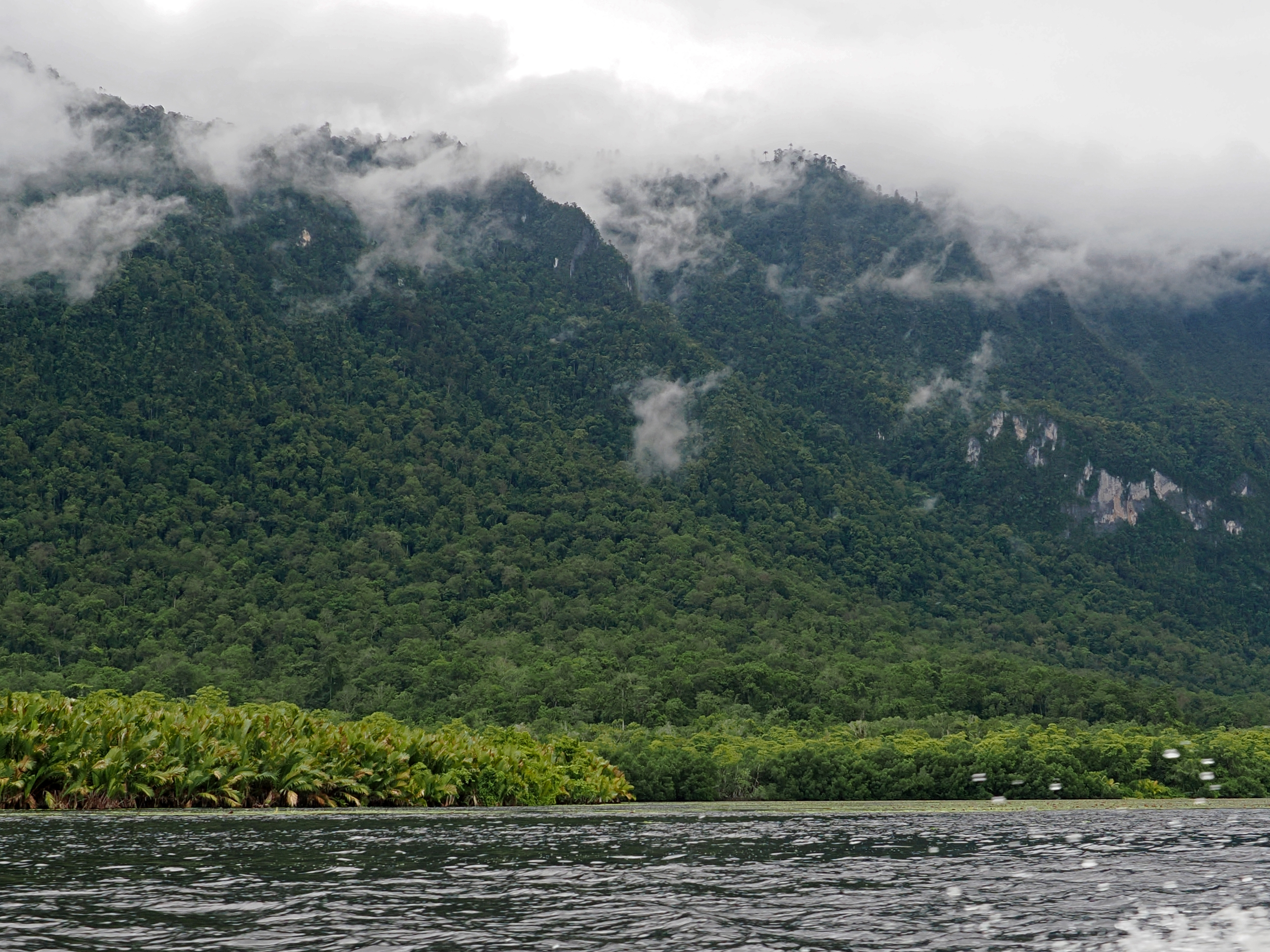
The Kaimana IPA comprises most of the southern part of the Bird’s Neck of western New Guinea. Flanking the Arafura Sea, it is delimited by Arguni Bay in the West and Triton Bay in the South. It is a landscape of numerous bays and lagunas, with rugged karst ridges occupying most of the inland area. These ridges, up to 1640 m in elevation, form a parallel series running from northwest to southeast. The northern border of the IPA is mainly formed by a long valley running NW to SE.

Botanical significance
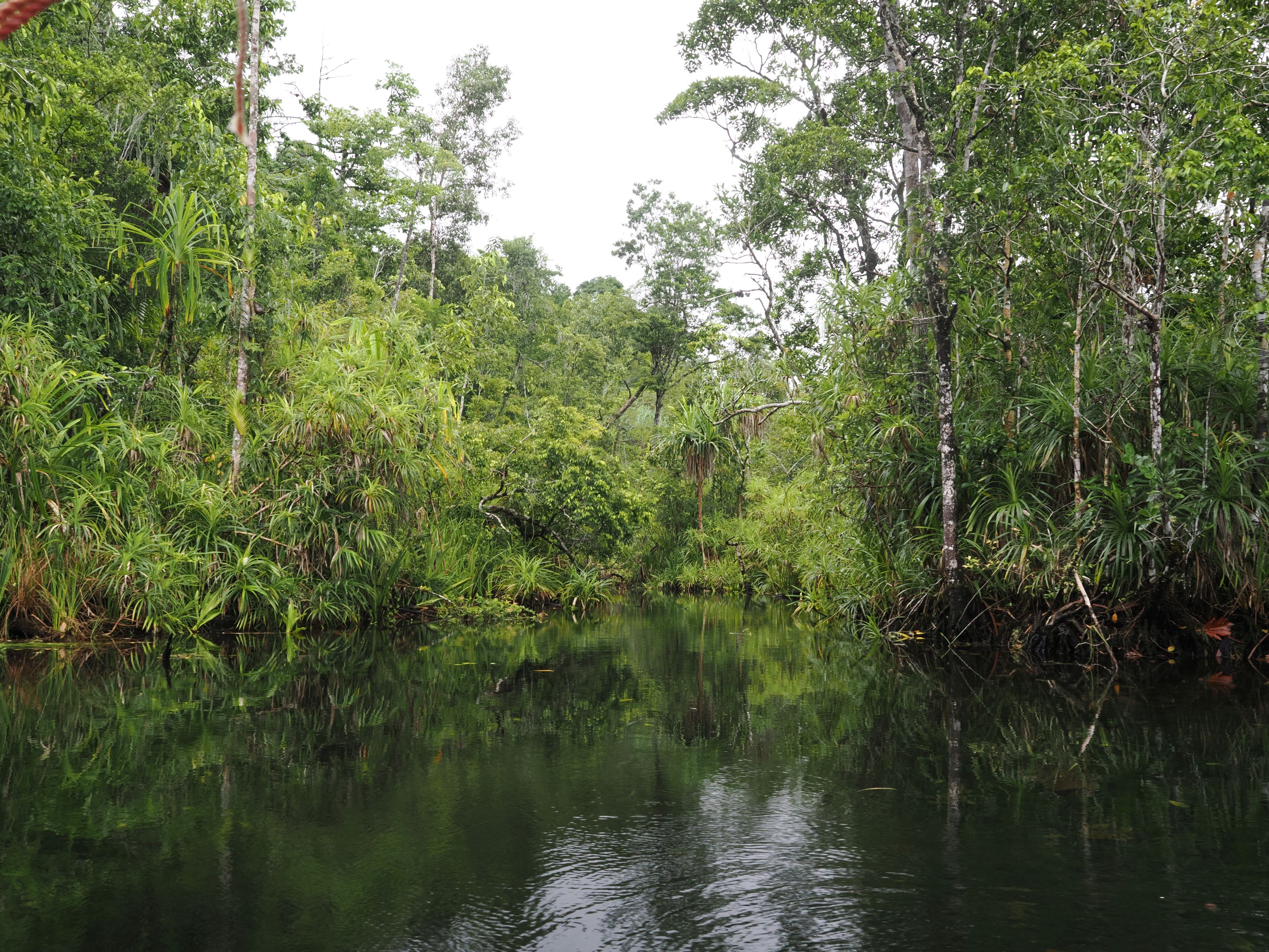
The area is poorly known botanically. Three recently described orchid species (Dendrobium centrosepalum, D. taeniocaule and Taeniophyllum pyriforme) are so far only recorded from this IPA. Two endangered (IUCN classification EN) slipper orchids are found here, although not exclusively so: Paphiopedilum glanduliferum (including its probable type locality, Triton Bay) and P. papuanum. There is a unique assemblage of coastal, riverine, and karst vegetations in close proximity with at present little or no human disturbance in many places. Intact transition zones from salt water to freshwater habitats, and from marshy lowland vegetation to densely forested ridges up to 1640 m elevation can be observed. The riverine forests are rich in epiphytes, including many orchids, ferns, and ant plants (Rubiaceae), and the clear water in the rivers between the hills is full of aquatic plants, including Cryptocoryne sp. Next to nothing is known about the flora at higher elevations, which will undoubtedly contain endemic species. The marine habitats in Triton Bay are among the most species-rich in the world.
Habitat and geology
There are extensive coastal habitats, including cliffs and mangrove / Nipa forests, swamp and riverine forests, densely forested hill slopes and ridges, as well as localised marshy areas, lakes, and some open vegetation on white-sand (the latter so far only known anecdotally). Several endemic species of rainbowfish have been described from the area, for example Melanotaenia kamaka, which is now a well-known aquarium fish. It is endemic to one lake in the Kaimana IPA. Geologically, the entire area can be termed a karst landscape and is part of the Lengguru fold and thrust belt.
Conservation issues
There is logging of lowland forest, so far mainly in coastal areas. The area has great potential for tourism, especially scuba diving. The coral reefs fringing the coast have close to world record numbers of fish species (Alan & Erdmann 2009). Development for tourism could cause damage to coastal vegetation, and destruction of inland vegetation could cause erosion and sedimentation issues, which could pose a threat to marine habitats.
Ecosystem services
The forests prevent erosion and are a source of wood and non-timber forest products for the indigenous people. Coastal swamp forest is an important breeding ground for various marine organisms, including the salt-water crocodile (Crocodylus porosus).
Site assessor(s)
Assessed by:
Andre Schuiteman, Royal Botanic Gardens Kew
Laura Jennings, Royal Botanic Garden Kew
Jimmy Wanma, State University of Papua
Charlie D. Heatubun, The Provincial Government of West Papua and Universitas Papua
Date of first assessment: 31st Oct 2025
IPA criterion A species
| Species | Qualifying sub-criterion | ≥ 1% of global population | ≥ 5% of national population | 1 of 5 best sites nationally | Entire global population | Socio-economically important | Abundance at site |
|---|---|---|---|---|---|---|---|
| Dendrobium centrosepalum Schuit., Juswara & Droissart | A(iii) |  |
|
|
|
 |
Unknown |
| Dendrobium taeniocaule Schuit., Juswara & Droissart | A(iii) | |
|
|
|
|
Unknown |
| Taeniophyllum pyriforme Schuit., Juswara & Droissart | A(iii) | |
|
|
|
|
Unknown |
| Paphiopedilum glanduliferum (Blume) Stein | A(i) | |
|
|
|
|
Unknown |
| Paphiopedilum papuanum (Ridl.) L.O.Williams | A(i) | |
|
|
|
|
Unknown |
Dendrobium centrosepalum Schuit., Juswara & Droissart
Qualifying sub-criterion:
A(iii)
≥ 1% of global population:
≥ 5% of national population:
1 of 5 best sites nationally:
Entire global population:
Socio-economically important:
Abundance at site:
Unknown
Dendrobium taeniocaule Schuit., Juswara & Droissart
Qualifying sub-criterion:
A(iii)
≥ 1% of global population:
≥ 5% of national population:
1 of 5 best sites nationally:
Entire global population:
Socio-economically important:
Abundance at site:
Unknown
Taeniophyllum pyriforme Schuit., Juswara & Droissart
Qualifying sub-criterion:
A(iii)
≥ 1% of global population:
≥ 5% of national population:
1 of 5 best sites nationally:
Entire global population:
Socio-economically important:
Abundance at site:
Unknown
Paphiopedilum glanduliferum (Blume) Stein
Qualifying sub-criterion:
A(i)
≥ 1% of global population:
≥ 5% of national population:
1 of 5 best sites nationally:
Entire global population:
Socio-economically important:
Abundance at site:
Unknown
Paphiopedilum papuanum (Ridl.) L.O.Williams
Qualifying sub-criterion:
A(i)
≥ 1% of global population:
≥ 5% of national population:
1 of 5 best sites nationally:
Entire global population:
Socio-economically important:
Abundance at site:
Unknown
General site habitats
| General site habitat | Percent coverage | Importance |
|---|---|---|
| Forest - Subtropical/Tropical Moist Lowland Forest | |
Major |
| Forest - Subtropical/Tropical Swamp Forest | |
Minor |
| Marine Coastal/Supratidal - Coastal Caves/Karst | |
Minor |
| Marine Neritic (Submergent Nearshore Continental Shelf or Oceanic Island) - Coral Reef | |
Minor |
| Rocky Areas - Rocky Areas [e.g. inland cliffs, mountain peaks] | |
Major |
Forest - Subtropical/Tropical Moist Lowland Forest
Percent coverage:
Importance:
Major
Forest - Subtropical/Tropical Swamp Forest
Percent coverage:
Importance:
Minor
Marine Coastal/Supratidal - Coastal Caves/Karst
Percent coverage:
Importance:
Minor
Marine Neritic (Submergent Nearshore Continental Shelf or Oceanic Island) - Coral Reef
Percent coverage:
Importance:
Minor
Rocky Areas - Rocky Areas [e.g. inland cliffs, mountain peaks]
Percent coverage:
Importance:
Major
Bibliography
Reef fishes of the Bird’s Head Peninsula, West Papua, Indonesia
Check List, Vol 5(3), page(s) 587–628.


Recommended citation
Andre Schuiteman, Laura Jennings, Jimmy Wanma, Charlie D. Heatubun (2026) Tropical Important Plant Areas Explorer: Kaimana (New Guinea). https://tipas.kew.org/site/kaimana/ (Accessed on 25/08/2026)