
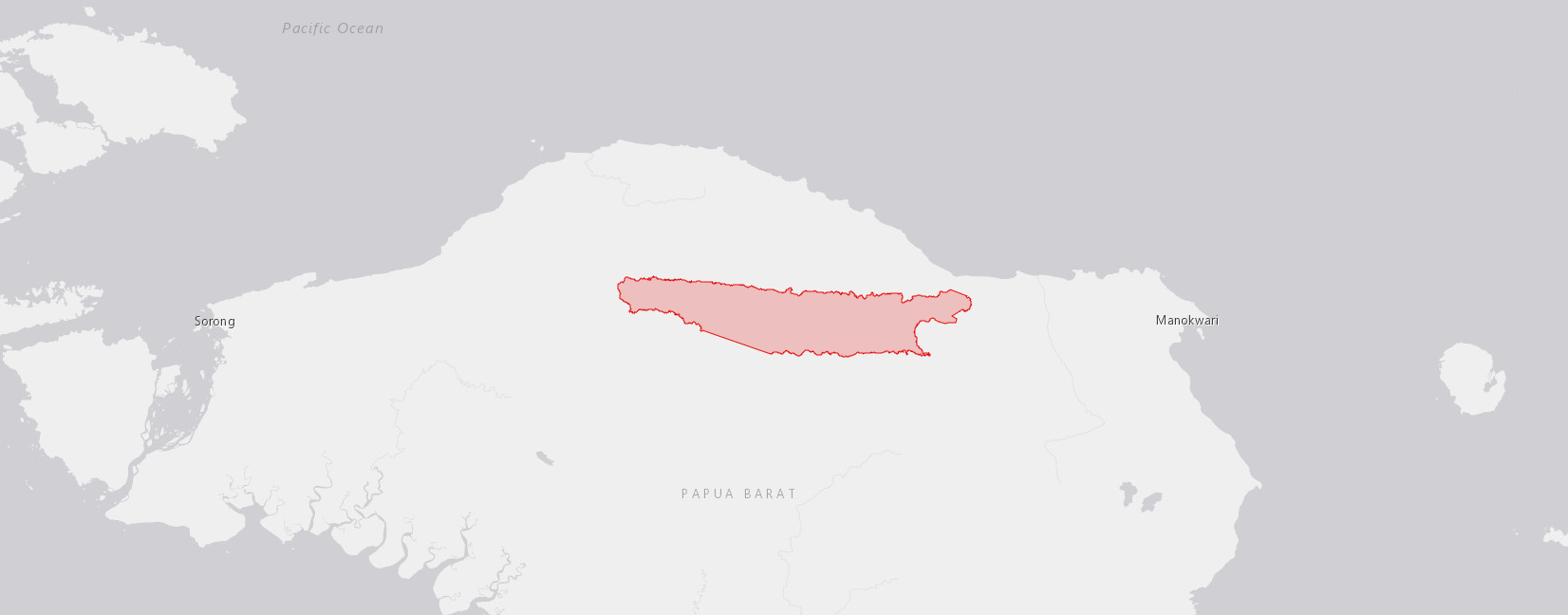
Country: New Guinea
Administrative region: Papua (Province)
Central co-ordinates: 0.773 S, 132.42000 E
Area: 1738km²
Qualifying IPA Criteria
A(i)Site contains one or more globally threatened species
IPA assessment rationale
7 site endemic species: Capparis kebarensis, Hydriastele simbiakii (DD), Diospyros aifatensis, Vaccinium adenotrichum (DD), Vaccinium ambivalens (LC), Astronia bullata (DD), Drypetes glaberrima (DD)
Site description
The Kebar Selatan TIPA includes the Kebar Valley, the foothills of the Tambrauw mountain range to the north, and the foothills and some of the higher parts of the Tambrauw mountain range to the south. The Kebar valley comprises savanna grasslands intermixed with areas of forest. Several rivers flow through the valley, increasing the fertility of the grassland. The foothills of the mountains flanking the valley are forested.
The valley is populated by several indigenous groups, including the Mpur, Ireres and Miyah; the Mpur have overall responsibility for the land. The communities have a close connection with the environment, sourcing most of their food and medicines from the forest, and growing fruits and vegetables in their gardens (small areas of cleared land) for their own or local consumption. Handwoven baskets (noken) are made from fibrous plants and bark. The forests are used for hunting deer and pigs, and fish are caught from the rivers. Animals such as pigs are often kept for additional income.
Timber such as ironwood (Intsia bijuga) and mantoa (Pometia pinnata) is sold for house building. The ‘Kebar grass’, rumput kebar (Biophytum petersianum, Oxalidaceae) is used medicinally to improve fertility. Since the arrival of missionaries in 1947, groundnuts have been introduced into cultivation. PT. BAPP planned to establish oil palm plantations in the valley, but the communities rejected the re-purposing of their land; corn plantations were planted as an alternative with some skepticism over the agreement. There has been immigration to the area because of increased accessibility on the paved road connecting Manokwari with Sorong. There is a small airfield in the central part of the valley, along with the local government office, school, medical centre and dwellings.
Botanical significance
There are seven plant species endemic to this area: Capparis kebarensis, Hydriastele simbiakii, Diospyros aifatensis, Vaccinium adenotrichum, Vaccinium ambivalens, Astronia bullata, Drypetes glaberrima.
None have a full conservation assessment: Capparis kebarensis, Drypetes glaberrima and Hydriastele simbiakii are provisionally listed as Data Deficient; others are not yet evaluated.
A further 11 plant species are present that are endemic to the wider Bird’s Head: Amyema kebarensis, Clethra kebarensis, Ilex emmae, Gaultheria pendens, Polyscias vogelkopiensis, Calamus superciliatus, Hydriastele montana, Hydriastele variabilis, Hopea inexpectata, Pseuderanthemum sorongense, Vaccinium cavendishioides.
Ilex emmae is listed as CR; Calamus superciliatus is VU; Hopea inexpectata is CR. Four species have a broader distribution, extending beyond the Bird’s Head into Papua and/or Papua New Guinea.
Cyrtostachys excelsa (CR) is recorded from two collections only, one from Nabire and the other from the Kebar valley.
Polyscias sleumer (VU) is known from Kebar, the Arfak mountains and the Bomberai peninsula. Gyrinops caudata (VU), with the vernacular name Gaharu, is present in the east of the Bird’s Head and in Central and Gulf provinces of Papua New Guinea. Kania platyphylla, not yet evaluated, is recorded from Biak and the Kebar area.
Habitat and geology
Savanna dominated by Imperata cylindrica with numerous other herbaceous species within, especially on the edges of forest patches.
Lowland forest, 400-700m, occurs at the edges of the valley, especially towards the far eastern and western areas of the TIPA; in the central savannah areas, forest patches are sporadic, occurring around water sources.
Lower montane forests, 700-1500m, are present on the foothills and mid-range areas of the mountains flanking the valley.
Mid-montane forests, 1500-2500m are present at the highest elevations in the area.
Geology:
Sedimentary Rocks, Neogene
Sedimentary Rocks, Jurassic to Cretaceous
Intermediate Grade Metamorphic Rocks, Paleozoic
Conservation issues
The central part overlaps with the Kebar Valley KBA, to the north is the Tamrau Utara KBA and nature reserve, and to the south is the Pegunungan Tamrau Selatan nature reserve, the latter two managed by Balai Besar Konservasi Sumber Daya Alam (BBKSDA), the Indonesian Natural Resources Conservation Centre. However, areas currently unprotected are subject to several threats.
There is a risk of burning of lower foothills for gardens which could cause expansion of grassland and/or degradation of soil
Tourists are attracted to Sontiri Hill (teletubbies hill) - grassland with views over the valley. This could lead to possible erosion of grassland because of walking and unofficial road making. The Hot Springs development could encroach on forest patches.
Road building is a concern: the major road that connects Manokwari to Sorong runs through the valley, now paved, has increased accessibility to the area. A new road has been built to connect various villages in the Kebar Selatan area with the Kebar valley, including Kampung Meiwar, Akari until Aruani, which could also cause further habitat loss, especially since it is close to the border with the Pegunungan Tamrau Selatan nature reserve.
Further threats recorded under the IUCN assessment for Ilex emmae include local mining activities. In addition, there are threats to wildlife including deer, cockatoos, birds of paradise and other endemic birds such as Maleo Waigeo (Aepypodius bruijnii) Cassowary and the Warsia (Mblyornis inornatus) from hunting, which may increase due to more immigration to the area. Expanding plantations will lead to deforestation, and could affect river water quality, impacting on fish populations.
Ecosystem services
Forested areas provide habitat for wildlife as well as soil stability, especially on the foothills and higher areas of the valley sides, and sources of food for the local population. Rivers are sources of drinking water and well as drainage for the valley. Naturally occurring hot springs and waterfalls are attractive to tourists.
Non plant endemics:
Cardiodactylus quatei Otte and Melanetettix truncatus
Site assessor(s)
Assessed by:
Gemma Bramley, Royal Botanic Gardens Kew
Laura Jennings, Royal Botanic Garden Kew
Jimmy Wanma, State University of Papua
Charlie D. Heatubun, The Provincial Government of West Papua and Universitas Papua
Date of first assessment: 23rd Nov 2025
IPA criterion A species
| Species | Qualifying sub-criterion | ≥ 1% of global population | ≥ 5% of national population | 1 of 5 best sites nationally | Entire global population | Socio-economically important | Abundance at site |
|---|---|---|---|---|---|---|---|
| Capparis kebarensis Fici | A(iii) |  |
|
|
|
 |
Unknown |
| Hydriastele simbiakii Heatubun, Petoe & W.J.Baker | A(iii) | |
|
|
|
|
Unknown |
| Diospyros aifatensis Kosterm. | A(iii) | |
|
|
|
|
Unknown |
| Astronia bullata J.F.Maxwell | A(iii) | |
|
|
|
|
Unknown |
| Vaccinium adenotrichum Sleumer | A(iii) | |
|
|
|
|
Unknown |
Capparis kebarensis Fici
Qualifying sub-criterion:
A(iii)
≥ 1% of global population:
≥ 5% of national population:
1 of 5 best sites nationally:
Entire global population:
Socio-economically important:
Abundance at site:
Unknown
Hydriastele simbiakii Heatubun, Petoe & W.J.Baker
Qualifying sub-criterion:
A(iii)
≥ 1% of global population:
≥ 5% of national population:
1 of 5 best sites nationally:
Entire global population:
Socio-economically important:
Abundance at site:
Unknown
Diospyros aifatensis Kosterm.
Qualifying sub-criterion:
A(iii)
≥ 1% of global population:
≥ 5% of national population:
1 of 5 best sites nationally:
Entire global population:
Socio-economically important:
Abundance at site:
Unknown
Astronia bullata J.F.Maxwell
Qualifying sub-criterion:
A(iii)
≥ 1% of global population:
≥ 5% of national population:
1 of 5 best sites nationally:
Entire global population:
Socio-economically important:
Abundance at site:
Unknown
Vaccinium adenotrichum Sleumer
Qualifying sub-criterion:
A(iii)
≥ 1% of global population:
≥ 5% of national population:
1 of 5 best sites nationally:
Entire global population:
Socio-economically important:
Abundance at site:
Unknown
General site habitats
| General site habitat | Percent coverage | Importance |
|---|---|---|
| Savanna - Moist Savanna | |
Major |
| Forest - Subtropical/Tropical Moist Lowland Forest | |
Major |
| Forest - Subtropical/Tropical Moist Montane Forest | |
Minor |
Savanna - Moist Savanna
Percent coverage:
Importance:
Major
Forest - Subtropical/Tropical Moist Lowland Forest
Percent coverage:
Importance:
Major
Forest - Subtropical/Tropical Moist Montane Forest
Percent coverage:
Importance:
Minor
Land use types
| Land use type | Percent coverage | Importance |
|---|---|---|
| Agriculture (pastoral) | |
Major |
| Agriculture (arable) | |
Minor |
| Residential / urban development | |
Minor |
| Tourism / Recreation | |
Minor |
| Harvesting of wild resources | |
Minor |
Agriculture (pastoral)
Percent coverage:
Importance:
Major
Agriculture (arable)
Percent coverage:
Importance:
Minor
Residential / urban development
Percent coverage:
Importance:
Minor
Tourism / Recreation
Percent coverage:
Importance:
Minor
Harvesting of wild resources
Percent coverage:
Importance:
Minor


Recommended citation
Gemma Bramley, Laura Jennings, Jimmy Wanma, Charlie D. Heatubun (2026) Tropical Important Plant Areas Explorer: Kebar Selatan (New Guinea). https://tipas.kew.org/site/kebar-selatan/ (Accessed on 24/08/2026)